Satellites can help us in a variety of different ways when it comes to protecting the future of life on this planet. Especially when it comes to getting an overview of large areas of land or water, and assessing their health and wellbeing, images from space are an important tool. But satellites can also play a key role when it comes to expanding the spread of renewable energies and speeding up the transition to cleaner power.
Glint Solar: Satellites pinpointing the ideal spot for floating solar installations
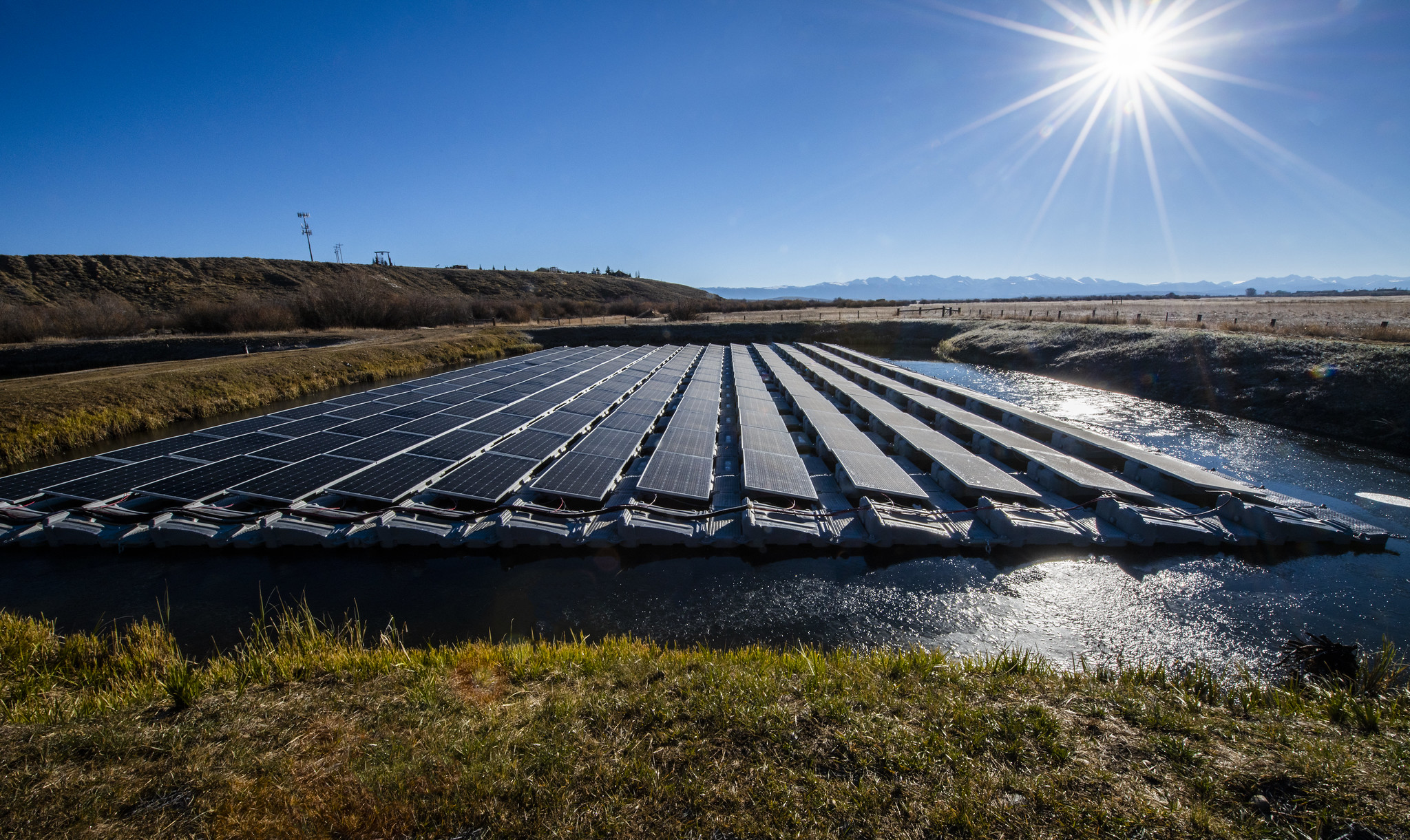
“Floating solar is the next big thing within solar energy,” states the Glint Solar website. The Norwegian company is specialised in “floating solar”, i.e. solar power systems that float on water, on top of containers filled with air.
Floating solar panels have several advantages: not only do they not require any land for their installation, but the solar cells are in fact cooled by the water that they float upon, which increases their energy efficiency. Especially on artificial water surfaces, such as water treatment plants or still waters in quarries, coastal regions or lakes, floating solar systems can offer a good alternative. However, the search for a suitable location has traditionally been laborious and time-consuming.
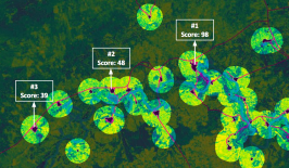
This is where the company from Norway comes in. Using ESA satellite imagery, Glint Solar is able to create a feasibility analysis based on site-specific data to facilitate the siting of new photovoltaic installations. The results of these analyses can then be handed over to project managers who are working on new floating solar projects.
The satellite images provide information on solar radiation, basic weather data and information on site-specific shade, wind, waves, water fluctuations and air pollution. The Site Evaluator Engine (SEE), the company’s analysis tool, matches the site-specific data with Glint Solar’s database and produces a report that ranks installation options with estimated yield, cost of installation and how long it will take to see a return on financial investment.
Glint Solar is supported by funding from the ESA in Norway (Business Incubation Centre Norway) and from the Norwegian government (Innovation Norway), both keen to see space technology be used for the promotion of solar power.
Solarmapper: Site analysis for solar in the southwestern United States
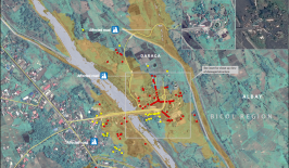
Similar to Glint Solar, the US company Solarmapper focuses on finding the ideal location for solar installations, but with a focus on solar systems that are installed on land. Via an interactive map, users are able to see and explore a range of different information that is key for selecting a suitable location for a solar panel installation. Different layers of the map display information about land use and previous solar energy projects, for example from the Bureau of Land Management (an agency of the US Department of the Interior that takes care of the management and economic utilisation of public land). For now, information is only available for the southwestern United States.
The maps are available free of charge and can be downloaded and printed. The web application is funded by the Office of Energy Efficiency and Renewable Energy of the U.S. Department of Energy and the Bureau of Land Management. It was developed by Argonne National Laboratory in collaboration with the Solar Energy Industries Association.
While solar installations are a win for the environment when compared to fossil fuels, installing a photovoltaic system – on water or on land – always has an impact on the surrounding ecosystem. That’s why it’s important for the location of solar installations to be chosen carefully and on the basis of detailed data. Working with satellite images, like in these two examples, could help make future solar installations more efficient, successful and overall more sustainable both in terms of the energy transition and the environment.
This article is part of the RESET Special Feature “Satellites for Sustainable Development”. Click here to explore all of the articles in the series.