When disaster strikes, often the first thing rescuers need is information. They need to know the area that is affected, the likely number of people involved and what infrastructure is available to them to assist in a rescue. But in a rapidly evolving situation filled with panic and misinformation, even gaining simple insights can be extremely challenging. However, new technologies are being developed which are designed to give this in depth timely information speedily and cheaply.
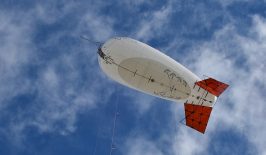
UrbanSky is a Colorado-based startup which has been developing buzz – and funding – for a new breed of aerial photography. They have been pioneering the use of cheap, reusable balloons to provide high quality aerial photographs. Importantly, their target audience are users and sectors who would traditionally have difficulty developing their own photography due to cost reasons. This means their method of providing a bird’s eye view could become more accessible to diverse groups including smaller business, civic society actors, charities and farmers.
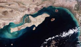
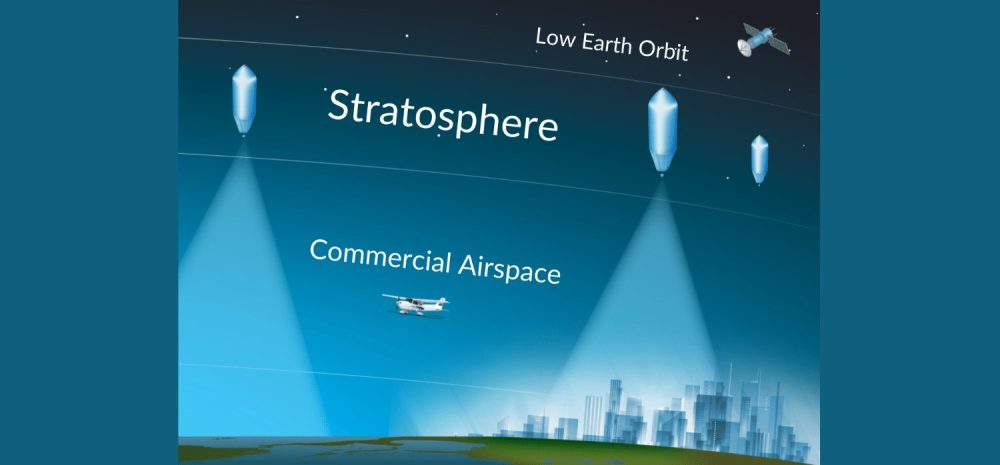
Usually satellites, aircraft and drones have been relied upon to provide aerial photography, but each of these comes with a series of pros and cons. Satellites are great for a vast overview, but their quality plummets when zooming into smaller details. Furthermore, they take time to get into position, and archived photographs could be years out of date. Drones, on the other hand, are excellent at close up aerial photography but poorer at providing a larger perspective. Aircraft can fill this intermediate role, but they come with huge cost barriers as well as fuel limitations.
UrbanSky’s approach makes use of ‘microballoons’, 5.5-metre diametre helium filled balloons carrying customised camera and sensor equipment. When on the ground, the balloon in partially filled with helium and rises from its mobile launch point. At this point, the balloon is even smaller at around 2.5 metres, making it easy to transport and deploy. Once it has reached its desired altitude in the stratosphere – generally around 18,000 metres – the balloon can siphon off gas through vents to maintain its position.
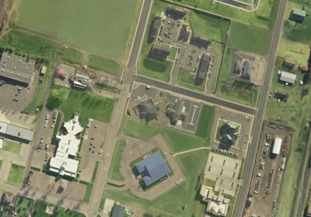
As it moves through the air, the camera rotates taking photographs. These are then stitched together to create a single composite photograph of a certain area. UrbanSky claims their 10cm GSD 3-band aerial imagery is better than the highest resolution commercial satellite imagery available on the market.
Once the microballoon has finished its mission, the ground crew releases the camera module, which inverts the balloon, releasing the remaining gas and starting a freefall. Then, at lower altitude, a parachute is deployed and the camera and balloon safely return to earth. Using this approach, UrbanSky claims around 1,000 square kilometres can be photographed an hour.
As a commercial enterprise, UrbanSky is seeking a wide variety of customers and charges around 5 USD per square mile. Although this means large scale photographs may start becoming increasingly pricey, it is still far cheaper than using aircraft for this purpose – or maintaining a satellite for that matter.
It is hoped the price range will put the microballoon within the budgets of organisations and individuals who would traditionally be unable to access this kind of bespoke information. On one level this could be civil society actors, for example groups looking to conduct environmental or urban surveys, or state environmental agencies looking to monitor natural resources. UrbanSky has already won a contract from the US Airforce to use its microballoons to provide real time monitoring of forest fires.
UrbanSky has also advertised their approach in relation to disaster relief efforts. Technology such as microballoons could certainly play a role in quickly providing a strategic overview of an affected area, while its resolution is also high enough to spot individuals. In this sense, the microballoon could soon join the growing tool set of digital and innovative technologies being made available to rescuers and charities, such as internet dispensing beacons, or community managed and curated digital maps.