When disaster strikes in countries of the Global South, humanitarian efforts can often be hampered by a lack of up-to-date and accurate information about ground and environmental conditions, as well as what infrastructure is available.
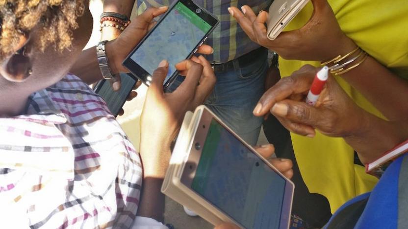
With this in mind, the Humanitarian OpenStreetMap Team (HOT) has been working since 2009 to harness the power of free, open source mapping technology and make it available to humanitarian actors in times of need. Through their team of thousands of volunteers, both on the ground and online, HOT’s goal is to scramble their resources during crises in order to thoroughly survey under-mapped regions of the world.
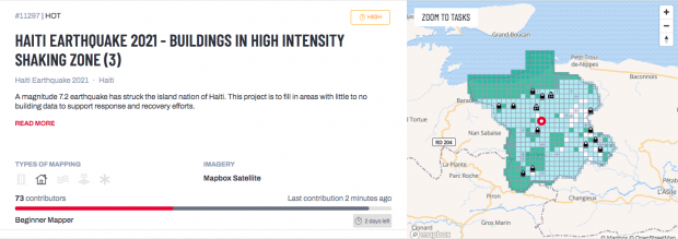
Since starting their project, they have been involved in the response to dozens of environmental and political crises, including fighting in Gaza, West African Ebola response and, more recently, the 2021 Haitian Earthquake. In practical terms, their Global Volunteer Community may look to provide information, such as the accurate routes of roads in a region, the location of smaller villages or even the interior of large buildings in cities. Often this information can be gleaned from many sources, including the close scrutiny of satellite and other images, as well as simple local knowledge. All of this can be of invaluable help to various agencies during a crisis.
The Humanitarian OpenStreetMap Team, as their name suggests, heavily utilises the OpenStreetMap platform released in 2004. Although similar to Google Maps or other mapping platforms, the wiki nature of OpenStreetMaps allows it to go into much greater detail than other, primarily satellite and map-based versions. For example, OpenStreetMap may include the location of pedestrian crossings, trees, the exact shape of pavements, or the presence of road and building works – even minor ones. Although this information might be convenient to locals, it is also of vital importance to NGOs who may need to move heavy equipment through poorly mapped regions, or ascertain the viability of certain routes.
Current projects, of which there are over 1,000, are separated by filterable search terms, including the difficulty of each mapping exercise. However, in the vast majority of cases, even beginner mappers can contribute to the projects. If situations become particularly critical, certain projects can be prioritized across the platform, bringing in extra support, including that from other NGOs. Once additions have been made, experienced community members check them for accuracy.
Among its many active projects, HOT is currently assisting agencies in South Sudan to distribute COVID vaccines to ‘last mile’ villages – those settlements often at the end of established supply and logistic routes. In Mogadishu, HOT is working to create internal blueprints of significant buildings for UN peacekeeping operations, while in Columbia, mappers are tracking the unfolding refugee crisis to see where groups are moving to and may be taking shelter.
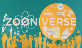
The HOT project is another example of the power of civic technology and citizen volunteers to mobilise large amounts of resources in a relatively small amount of time, and at usually a miniscule cost. Increasingly, similar approaches are being taken in the fields of scientific research, such as through the Zooniverse platform, to mobilise large numbers of contributors on a wide variety of topics. Not only do such efforts result in tangible results on the ground, but they can also act to empower individuals to feel they are actively part of a solution, as opposed to a mere bystander, or part of the problem. This can be especially important in the realms of humanitarian and environmental responsibility.
The article is part of our Special Feature “Civic Tech – Ways Out of the Climate Crisis with Digital Civic Engagement”. You can find all articles of the Special Feature here: Special Feature Civic Tech
The Special Feature is part of the project funding of the German Federal Environmental Foundation (Deutsche Bundesstiftung Umwelt – DBU), in the framework of which we are producing four special features over two years on the topic of “Opportunities and potentials of digitalisation for sustainable development”.
More information here.