object(WP_Query)#4838 (56) { ["query"]=> array(1) { ["custom_tags"]=> string(8) "wildlife" } ["query_vars"]=> array(71) { ["custom_tags"]=> string(8) "wildlife" ["error"]=> string(0) "" ["m"]=> string(0) "" ["p"]=> int(0) ["post_parent"]=> string(0) "" ["subpost"]=> string(0) "" ["subpost_id"]=> string(0) "" ["attachment"]=> string(0) "" ["attachment_id"]=> int(0) ["name"]=> string(0) "" ["pagename"]=> string(0) "" ["page_id"]=> int(0) ["second"]=> string(0) "" ["minute"]=> string(0) "" ["hour"]=> string(0) "" ["day"]=> int(0) ["monthnum"]=> int(0) ["year"]=> int(0) ["w"]=> int(0) ["category_name"]=> string(0) "" ["tag"]=> string(0) "" ["cat"]=> string(0) "" ["tag_id"]=> string(0) "" ["author"]=> string(0) "" ["author_name"]=> string(0) "" ["feed"]=> string(0) "" ["tb"]=> string(0) "" ["paged"]=> int(0) ["meta_key"]=> string(0) "" ["meta_value"]=> string(0) "" ["preview"]=> string(0) "" ["s"]=> string(0) "" ["sentence"]=> string(0) "" ["title"]=> string(0) "" ["fields"]=> string(3) "all" ["menu_order"]=> string(0) "" ["embed"]=> string(0) "" ["category__in"]=> array(0) { } ["category__not_in"]=> array(0) { } ["category__and"]=> array(0) { } ["post__in"]=> array(0) { } ["post__not_in"]=> array(0) { } ["post_name__in"]=> array(0) { } ["tag__in"]=> array(0) { } ["tag__not_in"]=> array(0) { } ["tag__and"]=> array(0) { } ["tag_slug__in"]=> array(0) { } ["tag_slug__and"]=> array(0) { } ["post_parent__in"]=> array(0) { } ["post_parent__not_in"]=> array(0) { } ["author__in"]=> array(0) { } ["author__not_in"]=> array(0) { } ["search_columns"]=> array(0) { } ["meta_query"]=> array(0) { } ["parsed_rml_folder"]=> int(0) ["ignore_sticky_posts"]=> bool(false) ["suppress_filters"]=> bool(false) ["cache_results"]=> bool(true) ["update_post_term_cache"]=> bool(true) ["update_menu_item_cache"]=> bool(false) ["lazy_load_term_meta"]=> bool(true) ["update_post_meta_cache"]=> bool(true) ["post_type"]=> string(0) "" ["posts_per_page"]=> int(9) ["nopaging"]=> bool(false) ["comments_per_page"]=> string(2) "50" ["no_found_rows"]=> bool(false) ["taxonomy"]=> string(11) "custom_tags" ["term"]=> string(8) "wildlife" ["order"]=> string(4) "DESC" ["use_rml_folder"]=> bool(false) } ["tax_query"]=> object(WP_Tax_Query)#6685 (6) { ["queries"]=> array(1) { [0]=> array(5) { ["taxonomy"]=> string(11) "custom_tags" ["terms"]=> array(1) { [0]=> string(8) "wildlife" } ["field"]=> string(4) "slug" ["operator"]=> string(2) "IN" ["include_children"]=> bool(true) } } ["relation"]=> string(3) "AND" ["table_aliases":protected]=> array(1) { [0]=> string(24) "x_rst_term_relationships" } ["queried_terms"]=> array(1) { ["custom_tags"]=> array(2) { ["terms"]=> array(1) { [0]=> string(8) "wildlife" } ["field"]=> string(4) "slug" } } ["primary_table"]=> string(11) "x_rst_posts" ["primary_id_column"]=> string(2) "ID" } ["meta_query"]=> object(WP_Meta_Query)#6708 (9) { ["queries"]=> array(0) { } ["relation"]=> NULL ["meta_table"]=> NULL ["meta_id_column"]=> NULL ["primary_table"]=> NULL ["primary_id_column"]=> NULL ["table_aliases":protected]=> array(0) { } ["clauses":protected]=> array(0) { } ["has_or_relation":protected]=> bool(false) } ["date_query"]=> bool(false) ["queried_object"]=> object(WP_Term)#7044 (11) { ["term_id"]=> int(12989) ["name"]=> string(8) "Wildlife" ["slug"]=> string(8) "wildlife" ["term_group"]=> int(0) ["term_taxonomy_id"]=> int(12989) ["taxonomy"]=> string(11) "custom_tags" ["description"]=> string(0) "" ["parent"]=> int(0) ["count"]=> int(9) ["filter"]=> string(3) "raw" ["term_order"]=> string(1) "0" } ["queried_object_id"]=> int(12989) ["request"]=> string(1164) "SELECT SQL_CALC_FOUND_ROWS x_rst_posts.ID FROM x_rst_posts LEFT JOIN x_rst_term_relationships ON (x_rst_posts.ID = x_rst_term_relationships.object_id) LEFT JOIN x_rst_icl_translations wpml_translations ON x_rst_posts.ID = wpml_translations.element_id AND wpml_translations.element_type = CONCAT('post_', x_rst_posts.post_type) WHERE 1=1 AND ( x_rst_term_relationships.term_taxonomy_id IN (12989) ) AND ((x_rst_posts.post_type = 'page' AND (x_rst_posts.post_status = 'publish' OR x_rst_posts.post_status = 'acf-disabled')) OR (x_rst_posts.post_type = 'post' AND (x_rst_posts.post_status = 'publish' OR x_rst_posts.post_status = 'acf-disabled'))) AND ( ( ( wpml_translations.language_code = 'en' OR 0 ) AND x_rst_posts.post_type IN ('post','page','attachment','wp_block','wp_template','wp_template_part','wp_navigation','popup','popup_theme','cookielawinfo','team' ) ) OR x_rst_posts.post_type NOT IN ('post','page','attachment','wp_block','wp_template','wp_template_part','wp_navigation','popup','popup_theme','cookielawinfo','team' ) ) GROUP BY x_rst_posts.ID ORDER BY x_rst_posts.post_date DESC LIMIT 0, 9" ["posts"]=> &array(9) { [0]=> object(WP_Post)#6712 (24) { ["ID"]=> int(103006) ["post_author"]=> string(5) "21497" ["post_date"]=> string(19) "2022-07-25 05:00:00" ["post_date_gmt"]=> string(19) "2022-07-25 05:00:00" ["post_content"]=> string(3412) "

Every year, countless marine mammals are permanently harmed and beached by the disorienting effects of military sonar. Two projects seek an ecological alternative by eavesdropping on ocean organisms to gain intel on underwater threats.  

One project, Persistent Aquatic Living Sensors (PALS), sees potential in listening to the snapping sound of shrimp (described as similar to that of frying bacon). Another project, the wonderfully named Grouper Guard, hopes to rely on the loud, low-frequency booms goliath groupers make when they perceive a threat.

Much like with sonar, military personnel would be alerted to the presence of a vehicle when it echoes back the sizzle of a shrimp colony. Or they could be tipped off by the groupers fussing over an intrusion of their territory.

Natural sonar and alert methods can also be harnessed for more than just military intelligence. As the BBC notes, “Tuning in to the sounds made by normal marine life, and learning how they change, would give researchers a low-cost, environmentally friendly way of tracking the impact of human activities underwater. This would be useful for projects like off-shore windfarms, oil drilling, and seabed mining.” Of course, a much greener solution would be to ditch ocean and fossil fuel mining altogether, but that’s another story. 

Still, there is doubt whether an ecosystem of living sensors can perform reliably. Sidharth Kaushal, a naval warfare specialist, points at past attempts to detect submarines using the glow of bioluminescent plankton. A sub was sunk once, allegedly, but other successes have been few and far between. "Cold War efforts by both the Soviets and the Americans to utilise [the plankton] in a systematic way came to nothing," says Kaushal. "Partially as they had no way of differentiating false positives, such as the reaction from a passing whale, from the real thing."

Be that as it may, we’ve made astronomical technological strides since the Cold War. The shrimp and grouper methods would be enhanced by algorithms, artificial intelligence and special software in order to reduce the noise, so to speak, and get more precise readings about the source and location of an object of interest. 

In any case, progress in the field is a win for whales, who are disproportionately victimised by sonar. As whales have their own sonar, any interfering sound waves from ships or submarines can distress them to the point of self-beaching. Together with satellite technology, marine life sonar could one day prevent such fates.

" ["post_title"]=> string(67) "How the "Sizzling Bacon" Sound of Shrimp Can Reduce Whale Beachings" ["post_excerpt"]=> string(171) "Researchers are exploring ways to monitor underwater human activity by listening to the natural sounds of sea creatures instead of using whale-harming methods like sonar. " ["post_status"]=> string(7) "publish" ["comment_status"]=> string(6) "closed" ["ping_status"]=> string(6) "closed" ["post_password"]=> string(0) "" ["post_name"]=> string(65) "how-the-sizzling-bacon-sound-of-shrimp-can-reduce-whale-beachings" ["to_ping"]=> string(0) "" ["pinged"]=> string(0) "" ["post_modified"]=> string(19) "2022-07-25 06:07:51" ["post_modified_gmt"]=> string(19) "2022-07-25 06:07:51" ["post_content_filtered"]=> string(0) "" ["post_parent"]=> int(0) ["guid"]=> string(27) "https://reset.org/?p=103006" ["menu_order"]=> int(0) ["post_type"]=> string(4) "post" ["post_mime_type"]=> string(0) "" ["comment_count"]=> string(1) "0" ["filter"]=> string(3) "raw" } [1]=> object(WP_Post)#6686 (24) { ["ID"]=> int(93742) ["post_author"]=> string(3) "390" ["post_date"]=> string(19) "2021-10-29 10:17:36" ["post_date_gmt"]=> string(19) "2021-10-29 10:17:36" ["post_content"]=> string(9380) "

When it comes to exotic birds, few are more popular as pets than cockatoos. With their high intelligence, affectionate behaviour and penchant for acrobatics, cockatoos, such as the yellow crested cockatoo, are now a familiar sight in many pet stores and animal markets across the world. 

However, their popularity as pets has led to their numbers in the wild dropping significantly, and the yellow cockatoo is now considered endangered in its native Indonesia - with only around 2,500 spread across the various islands.

The capture, export and sale of cockatoos is now restricted by law, but in many situations the official quotas are exceeded by a large margin. The illegal trade grabbed headlines in 2015, when a smuggler attempted to transport 24 yellow-crested cockatoos stuffed into plastic bottles.

Now, the Hong Kong University is developing new forensic methods which can quickly, and cheaply, identify the origin of cockatoos being sold in animal markets. Hong Kong, in particular, has its own special relationship with the cockatoo, as the city is home to a large wild urban population derived from escaped and released animals. However, investigations by the university team also revealed there are more birds for sale in the various pet markets than is possible given the legal quotas on cockatoo imports. This means some of the birds were illegally captured and smuggled into the market.

The teams new method uses stable isotope analysis to look into the diets of individual birds. The technology itself is not entirely new, and has been used from animal migration studies to research into prehistoric human diets. By examining the isotopes within a sample from an animal, a feather in the cockatoos’ case, the researchers can identify the levels of carbon and nitrogen within it. These elements will vary depending on the diet of the bird, which can then be used to deduce whether a particular bird was bred in captivity or taken from the wild.

If this is inconclusive, the team can delve even further, and examine the ​​​​carbon values of the specific amino acids of a specimen.

To develop their concept, the team embarked on an extensive survey of feathers both recovered from the wild and provided by owners of domesticated cockatoos. Developing a baseline from which comparisons can be made is essential to the accuracy of stable isotope analysis. All the work seemed to pay off. When they tested their approach using a sample of random feathers, they were successfully able to identify the wild feathers from the non-wild ones.

In theory, the stable isotope approach is not limited to cockatoos, or even birds. The approach can be applied to any living animal as long as their wild and captive diets vary enough. However, the practicality of the approach will vary greatly depending on the animal, largely due to the necessity of finding enough viable samples from wild animals to create a comparative baseline. Finding samples from cockatoos is easy enough, but grabbing a sample from endangenered animals such as the tiger, is a much more daunting prospect. Animals which regularly change their diet on a seasonal basis can also complicate the process.

Currently, the team is looking to further refine their approach so stable isotope analysis can be used as admissible evidence in court. The technology is still relatively novel, and it will take some further refinement before it can be used by law enforcement agencies.

However, it does have some other benefits in its favour. The basic analysis can be done quickly and cheaply, with results after only 24 hours. This is especially important if a large sample of animals was to be tested. The approach is also much cheaper than other methods of testing, making it a more attractive alternative. Although the more in-depth amino acid testing takes longer - around a week - it is also still much quicker than established testing methods.

Ultimately, the method could be made available to the public, so owners themselves can test their own animals to ensure they were legally purchased.

A Viral Trade Fuelled by Social Media

The sale in exotic pets is nothing new, however the development of new markets and new communication tools means the trade has now ballooned into a multi-million dollar blackmarket.

The trade is also highly receptive to consumer demand, which can fluctuate based on which exotic animals are currently “trending” on social media or Youtube videos. For example, after a video showing a captive slow loris eating rice balls went viral in 2015, it triggered a surge in demand and increased poaching for the pet trade. Other animals, such as grey parrots, Indian star tortoises and red-eyed tree frogs are also often targeted and essentially ‘laundered’ into the legal trade in these animals.

As well as leading to destruction of the native wild populations of these animals, the illegal pet trade also results in other issues. Firstly, even if the animals themselves reach a caring owner, they often have to endure terrible conditions which can cause long term harm, especially to intelligent animals such as parrots. Secondly, the introduction of unverified wild animals also poses a biohazard in terms of transferable diseases. In the US throughout the 1970s, there was an outbreak of the exotic Newcastle disease (END), which resulted in the deaths of 12 million birds in the U.S. The virus was thought to originate from illegally important parrots from South America.

Furthermore, many of these exotic animals are often later abandoned, often when the expense of their care becomes prohibitive, or they fall out of ‘fashion’. Deliberately released animals then pose a threat to native biodiversity.

" ["post_title"]=> string(79) "New Forensic Tools Can Spot Illegally Traded Exotic Birds with a Single Feather" ["post_excerpt"]=> string(221) "Animals which are critically endangered in the wild, are becoming increasingly common sights in pet markets around the world. New tools may help the authorities separate the captive-bred from those snatched from the wild." ["post_status"]=> string(7) "publish" ["comment_status"]=> string(6) "closed" ["ping_status"]=> string(6) "closed" ["post_password"]=> string(0) "" ["post_name"]=> string(79) "new-forensic-tools-can-spot-illegally-traded-exotic-birds-with-a-single-feather" ["to_ping"]=> string(0) "" ["pinged"]=> string(0) "" ["post_modified"]=> string(19) "2022-07-21 12:43:07" ["post_modified_gmt"]=> string(19) "2022-07-21 12:43:07" ["post_content_filtered"]=> string(0) "" ["post_parent"]=> int(0) ["guid"]=> string(26) "https://reset.org/?p=93742" ["menu_order"]=> int(0) ["post_type"]=> string(4) "post" ["post_mime_type"]=> string(0) "" ["comment_count"]=> string(1) "0" ["filter"]=> string(3) "raw" } [2]=> object(WP_Post)#6687 (24) { ["ID"]=> int(40352) ["post_author"]=> string(3) "411" ["post_date"]=> string(19) "2020-09-03 12:45:57" ["post_date_gmt"]=> string(19) "2020-09-03 12:45:57" ["post_content"]=> string(7164) "Air Shepherd flies drones to stop poaching. To date, they’ve piloted over 4,000 missions to stop rhino and elephant poachers. In their own words, their work is “reversing the march of extinction”. Here’s how.It's an exceptionally sad state of affairs that, in 2020, the illegal ivory and rhino horn trades are both booming international industries. Ivory has been seen as a luxury since time immemorial. In some parts of the world this hard, white material is considered as valuable as gold, making it a coveted status symbol. Wealthy tourists from the West, presumably looking to decorate their mantels, are also known for smuggling it home in their suitcasesThe biggest market for keratinous rhino horn, however, is believed to be Vietnam, where they, measured and valued by the kilo, can fetch tens of thousands of dollars. Like ivory, rhino horn is a marker of wealth, but many are also convinced of its medicinal value, despite the fact that repeated scientific studies have failed to corroborate this claim.The demand for tusks and horns is propelling both the rhino and elephant to extinction. At the current rate, it’s expected that both animals could be extinct within the next two decades. The problem has never been so urgent.But poaching in African countries, where diminishing populations of rhinos and elephants still roam, is a notoriously stubborn issue. Given how lucrative the industry for ivory and rhino horn is, perhaps that's not surprising: poaching can be extremely profitable, and for some locals, other sorts of gainful employment aren’t easy to come by. Add to that governmental corruption and the impenetrable nature of the crime syndicates responsible for the global poaching industry, and the problem can seem impossible to overcome.Of course, because of increasing desperation to preserve vulnerable species, conservationists have also stepped up their efforts to fight illegal poaching and the technologies they use to do it - from flooding the market with fake rhino horns to using artificial intelligence to scan camera trap footage for evidence of foul play. But catching poachers in the act is no easy feat. They tend to work at night, when the cover of darkness makes tracking them across the vast African terrain nigh on impossible.That's where South Africa's Air Shepherd comes in.Air Shepherd uses a fleet of flying drones, replete with a high-tech AI, to scour the savannahs and catch poachers on the ground. The sophisticated technology was originally developed for the US military to identify roadside bombs in Iraq. Run by the non-profit Lindbergh Foundation, the Air Shepherd initiative has been described as "eyes in the sky" for the anti-poaching cause.

Drones Give Rangers the Upper Hand

It works like this: the drones, which look just like miniature planes, are flown over high probability areas, or deployed when the team has been tipped off about an upcoming poaching operation. Once a drone spots a poacher and their whereabouts is identified, the team radios nearby rangers, who can then intercept the suspects. The upper hand afforded by this technology tips the balance in favour of the rangers.Air Shepherd drones not only catch poachers: they also serve as a crucial deterrent for future illegal operations. Because of the darkness, the drones use not just ordinary night cameras but also heat-sensitive imaging, which makes it easy to spot not just the animals, but the humans too.The above video of Air Shepherd shows them in action - including their hushed late-night operations, with the Air Shepherd team closely monitoring several screens, some displaying GPS systems, others showing the darkened savannah. In other footage, poachers can be seen running away, suggesting that the planes have done their job. Originally started in South Africa, Air Shepherd has already been in operation for over four years now, during which time it has carried out over 4000 missions. Since its inception, Air Shepherd has launched in several other countries on the continent, including Malawi and Zimbabwe. Unfortunately, Air Shepherd has had to slow down since the Covid-19 pandemic hit.“It's been quite a challenge these last five months because we've been locked down in South Africa”, explained Otto Werdmuller Von Elgg of Air Shepherd. "Obviously the border's been closed.” However, the border limits imposed by the pandemic have led to Air Shepherd redirecting, rather giving up, its efforts, and wading into uncharted waters. "We have been doing stuff on the Cape Coast for a lot of illegal fishing," said Von Elgg. "We've been very successful there, we've had quite a lot of arrests. But obviously our core focus is more mammals. We hope to get back into the major parks and the cross-border stuff in the next few months."But of course, monitoring with drones cannot be the only solution. Rather, the aim is to develop a comprehensive approach that gets to the root of the poaching problem. Among other things, this includes reducing the poverty of the local population so that they no longer depend on illegal businesses to survive. As Otto Werdmuller Von Elgg emphasizes, an important step is to train the local population themselves as rangers and to remunerate the work accordingly.Air Shepherd is not the only project enlisting the help of high-tech drones for the good of the natural world. Drones are currently being deployed for positive impact all over the world - being flown to plant mangroves in Myanmar for example, prevent deforestation in the Amazon, and even to help tackle plastic pollution in Cambodia." ["post_title"]=> string(78) "Air Shepherd: Leading Rhinos and Elephants to Safety - With the Help of Drones" ["post_excerpt"]=> string(223) "

Air Shepherd flies drones to stop poaching. To date, they’ve piloted over 4,000 missions to stop rhino and elephant poachers. In their own words, their work is “reversing the march of extinction”. Here’s how.

" ["post_status"]=> string(7) "publish" ["comment_status"]=> string(6) "closed" ["ping_status"]=> string(6) "closed" ["post_password"]=> string(0) "" ["post_name"]=> string(55) "shepherding-rhinos-and-elephants-safety-drones-07262020" ["to_ping"]=> string(0) "" ["pinged"]=> string(0) "" ["post_modified"]=> string(19) "2022-07-06 15:15:39" ["post_modified_gmt"]=> string(19) "2022-07-06 15:15:39" ["post_content_filtered"]=> string(0) "" ["post_parent"]=> int(0) ["guid"]=> string(78) "http://reset.org/blog/shepherding-rhinos-and-elephants-safety-drones-07262020/" ["menu_order"]=> int(553) ["post_type"]=> string(4) "post" ["post_mime_type"]=> string(0) "" ["comment_count"]=> string(1) "0" ["filter"]=> string(3) "raw" } [3]=> object(WP_Post)#6681 (24) { ["ID"]=> int(40067) ["post_author"]=> string(3) "411" ["post_date"]=> string(19) "2020-05-20 05:55:30" ["post_date_gmt"]=> string(19) "2020-05-20 05:55:30" ["post_content"]=> string(9364) "With global biodiversity in crisis, conservationists around the world are devising more and more innovative ways to curb species loss. One of the latest initiatives is Wildlife Insights: a new tool that harnesses the power of AI to dramatically grow our knowledge about wildlife populations. But the project, which analyses photos taken on camera traps disguised in nature, may raise ethical questions too.Wildlife Insights describes itself as “saving biodiversity with tech and AI". The basic idea is fairly simple. Researchers from all over the world are free to batch upload photos that they’ve taken on hidden camera traps. These images are then fed into an AI, which analyses the images to identify the animal species’ captured. Given that these cameras routinely collect tens of thousands of images, it’s easy to imagine how drastically this could speed up the process of research. Consequently, conservationists could learn a lot more about what animals are living in particular areas, as well as tracking their movements. The data can be accessed from anywhere, including out in the field, via any device or computer. It's also accessible to everyone - meaning anyone can access and explore what's there and, even, potentially, leverage that data to influence policy and encourage decision-makers to act for the good of the animal world.Widespread use of camera traps is nothing new: researchers have been using them for decades now to observe wild animals and monitor their populations. A few decades ago, scientists wanting to learn more about these species had little choice but to get up close and personal with them – whether that meant living alongside animals à la Jane Goodall, or resorting to cumbersome options such as physical traps. The drawbacks of such invasive methods are obvious. Not only can human presence distort research; it can also have detrimental effects on the subjects that researchers profess to protect. Additionally, there are limits to these methods – observing nocturnal animals, for example, is a huge challenge.Enter technology. Cameras constructed especially for the purpose of capturing wildlife have, over the last 20 years or so, become ever-more advanced. Nowadays, we can tie motion-sensor camera traps discreetly to trees and even camouflage cameras in purpose-built animatronic animals.Of course, filming rarely runs without a hitch. Curious or suspicious animals regularly destroy these units, which has naturally prompted manufacturers to make them all the more indestructible. But there are other concerns. Installing these systems in certain areas can also have unforeseen consequences for humans.Since camera traps are usually used for benign ends – protecting vulnerable species, and gathering invaluable ecological knowledge – it may not be immediately obvious how such tools could actively harm humans. But “human bycatch” is common, and not everybody is happy about being caught on camera – whether that’s because they’re doing something wrong, or simply because their privacy has been breached.For some, it might not seem like such a big deal to be caught on a stroll through the forest, but some cases are highly problematic: take, for example, the time an Austrian politician’s sexual antics were caught on a camera trap, or the potential invasion of indigenous groups’ privacy. Then, of course, there’s the endemic issue of poaching. Consequently, many of these cameras are destroyed, with a frequency that suggests something deeper is afoot than random acts of vandalism.

The Ethical Implications of Camera Surveillance

Chris Sandbrook, a lecturer in Geography at Cambridge, has been examining the issue of camera trap surveillance for some time. Over the years, he’s heard chilling stories from colleagues in the field, including camera traps being used by local authorities as a form of social control. “These devices have got lots of really exciting and wonderful uses. I would never want to see them all banned or something like that,” says Sandbrook. But, he adds, they also come with ethical implications that must be considered.Sandbrook and his colleagues have been working on a set of guidelines for the appropriate use of surveillance technology in conservation, which he hopes may encourage greater caution and human rights respect for camera trap users. As Sandbrook acknowledges, the recently launched Wildlife Insights offers what seems, in many ways, like an invaluable service for researchers.Wildlife Insights uses a rapidly growing AI, which can sort through photos en masse and learn as it goes. Manually labelling these photos is a slow and tedious task: while an expert might be able to sift through and label 1000 photos in a day, Wildlife Insights’ AI can do 30,000 – and they’re hoping that number could eventually climb to 100,000. "We're faced with such an overwhelming data load these days,” says Tim O’Brien, a member of the Wildlife Insights team who has also worked with the Wildlife Conservation Society for 30 years. "Just from a data processing point of view, it's fantastic.”

O’Brien remembers a time before camera traps were widely available, and can recall what a thrill it was to discover their growing potential in the late 1990s. Wildlife Insights could certainly make a lot of conservationists' lives easier, as well as providing knowledge to the field that may not otherwise come to light. But again, there are potential concerns. A lot of the machine learning is built by Google, who also has access to the images. "We have a policy of not sharing or posting images of people,” O’Brien explains, though this doesn’t mean they won’t get uploaded as part of large batches, and he’s not sure yet what happens to these “human bycatch” images.“I suppose that's probably my general concern … what kind of insights Google might be drawing from the data,” says Sandbrook. “They [Google] don't seem to have the best record when it comes to managing people's data and using it for things that perhaps weren't what everyone thought they were doing with it.”There is little doubt that technology can be a panacea to the obstacles faced by many conservationists doing critical, and increasingly urgent, work. Wildlife Insights is yet another AI application that shows immense promise as another stepping stone towards protecting endangered species and precious natural ecosystems. But it also broaches some of the biggest questions posed in the digital era, from surveillance to big data. And by feeding potentially sensitive data into a Google-powered AI, it’s easy to see how privacy or human rights concerns might be vindicated. “I think these thoughts of the all-seeing eye do raise quite an important ethical question,” says Sandbrook. “I hope that they've thought them through and have some plans in place.”This article is part of the RESET Special Feature "Artificial Intelligence - Can Computing Power Save Our Planet?" Explore the rest of our articles in the series right here." ["post_title"]=> string(80) "Wildlife Insights: A Google-Built AI is Taking Animal Surveillance to New Levels" ["post_excerpt"]=> string(294) "

With global biodiversity in crisis, conservationists around the world are devising more and more innovative ways to curb species loss. One of the latest initiatives is Wildlife Insights: a new tool that harnesses the power of AI to dramatically grow our knowledge about wildlife populations." ["post_status"]=> string(7) "publish" ["comment_status"]=> string(6) "closed" ["ping_status"]=> string(6) "closed" ["post_password"]=> string(0) "" ["post_name"]=> string(80) "wildlife-insights-google-built-ai-taking-animal-surveillance-new-levels-05072020" ["to_ping"]=> string(0) "" ["pinged"]=> string(0) "" ["post_modified"]=> string(19) "2022-06-21 15:20:03" ["post_modified_gmt"]=> string(19) "2022-06-21 15:20:03" ["post_content_filtered"]=> string(0) "" ["post_parent"]=> int(0) ["guid"]=> string(103) "http://reset.org/blog/wildlife-insights-google-built-ai-taking-animal-surveillance-new-levels-05072020/" ["menu_order"]=> int(727) ["post_type"]=> string(4) "post" ["post_mime_type"]=> string(0) "" ["comment_count"]=> string(1) "0" ["filter"]=> string(3) "raw" } [4]=> object(WP_Post)#6711 (24) { ["ID"]=> int(39823) ["post_author"]=> string(3) "197" ["post_date"]=> string(19) "2020-02-16 19:56:06" ["post_date_gmt"]=> string(19) "2020-02-16 19:56:06" ["post_content"]=> string(7465) "In Germany, the rate of construction of new wind turbines has slowed dramatically - which could have fatal consequences for the energy transition. One of the reasons that new turbines face opposition is that the giant blades endanger near-flying birds. BirdVision is tackling the problem with the help of AI.With climate change continuing apace, we need to reduce our fossil fuel consumption and switch over to renewable energies as fast as we can. But in the biggest country in Europe, the growth of wind energy - an incredibly efficient source of energy that the country will rely on to reach its renewable energy targets - has slowed to stagnation point in the past few years.There are numerous reasons why - including changes in government subsidies, the time it takes to issue permits for new wind turbines (it used to take just 10 months, but now can take over two years), and also unclear targets for planners with regard to land allocation and legal disputes. In addition to all that, all around the country, civil society groups are forming and filing lawsuits against planned sites - complaining about the increased noise level and also the visual impact that wind turbines have on the surrounding landscape. New regulations take these factors into account, meaning that no new turbines can be built within a certain radius of where people are living. The result of this is that there are hardly any spaces that are suitable for new wind turbines (all the more absurd when you consider all the things that are allowed to be built closer to residential buildings than a wind turbine: including motorways, coal-fired power stations, airports, landfills...).Another point of criticism is the suggestion that wind turbines threaten wildlife, which is repeatedly cited by both citizens' initiatives and nature conservation organisations. In recent years, all this has led to the refusal of permits or to considerable restrictions on the construction of new turbines.

"This is where we want to take action, providing the industry with a camera system that detects bird species flying too close to the wind turbines, and pausing them before they do any harm. The aim is to avoid endangering any wildlife at all,"
Benjamin Friedle, one of the three managing directors of BirdVision, explained to RESET. Since the beginning of 2018, the partners have been developing the "BirdVision" camera system together with the Bürgerwindpark Hohenlohe, phil-vision GmbH (a company that specialises in image processing) and Dr Michal Lewandowski, a specialist in neural networks and tracking. The system is designed to detect and track bird species that are potentially at risk of harm from wind turbines and protect them by switching off the turbines as soon as they approach.

BirdVision – Protecting Birds With Artificial Intelligence

BirdVision is a specially-developed camera system: high-performance outdoor industrial cameras are mounted at the foot of the wind turbine and connected to an image processing server. With the help of a neural deep learning network, birds that are potentially at risk of harm from wind turbines are detected via intelligent tracking. If one of the endangered birds approaches the turbine, the system registers it and switches off the blades as soon as it gets near. The servers are located directly in the tower of the wind turbine, they drawing their power directly from the turbine itself.In 2019 BirdVision was tested on eight wind turbines and so far, the team is satisfied with the results. The results are currently being compiled by external evaluators and will be published in a report, but according to Friedle, they've been able to achieve very high detection rates so far and the company plans to start small-scale production by the end of 2020. There is also allegedly a very high demand from industry: "particularly among project developers who are applying for new permits and finding it hard to get them approved and operators of existing wind turbines who are currently using very cost-intensive avoidance measures," says Friedle.

Short pauses, not long shutdowns

Wind turbines in France and Spain have already been fitted with similar camera systems - but those don't have the added advantage of AI. "We believe that when it comes to detection rate, false trigger rate and reliability, they simply can't compete with systems that use artificial intelligence" says Friedle.When you imagine the huge rotor blades found on industrial wind turbines it seems like it must be a huge technical feat to get them to stop. And surely bringing them to a halt has an economic disadvantage too, because when they're not moving, no electricity can be produced? The managing director of BirdVision disagrees: "Technically, we've been carrying out an identical shutdown for over five years when we turn off the blades to protect local bat populations. Depending on the weather, we have between 300 and 600 shutdowns in southern Germany during the summer months. Of course, no electricity is produced during the few minutes that each shutdown lasts. But that demand-oriented technical shutdown is already being offset by very cost-intensive blanket shutdowns and avoidance measures in countless wind farms. We would like to replace those with this technology."BirdVision is successfully bringing together wildlife protection and environmentally-friendly energy production. While at the same time, the team's solution hopes to make more land usable for more wind energy - land that is currently not available because of the dangers posed to local wildlife. "It's the job of federal and state legislators to work with the wind energy industry and nature conservation organisations to develop more practical and simpler solutions, of course" says Benjamin Friedle. Following BirdVision's lead, let's hope they will.This is a translation of an original article that first appeared on RESET's German-language site.
 
This article is part of the RESET Special Feature "Artificial Intelligence - Can Computing Power Save Our Planet?"The RESET Special Feature on AI is part of a project funded by the Deutschen Bundesstiftung Umwelt (German Federal Environmental Foundation DBU). As part of this project, over a period of two years we will be developing four RESET Special Features on the topic of "Opportunities and Potentials of Digitalisation for Sustainable Development".You can find more information here." ["post_title"]=> string(78) "In Germany, Artificial Intelligence Is Making Wind Turbines More Bird-Friendly" ["post_excerpt"]=> string(315) "

In Germany, the rate of construction of new wind turbines has slowed dramatically - which could have fatal consequences for the energy transition. One of the reasons that new turbines face opposition is that the giant blades endanger near-flying birds. BirdVision is tackling the problem with the help of AI.

" ["post_status"]=> string(7) "publish" ["comment_status"]=> string(6) "closed" ["ping_status"]=> string(6) "closed" ["post_password"]=> string(0) "" ["post_name"]=> string(90) "birdvision-artificial-intelligence-and-cameras-making-bird-friendly-wind-turbines-02162020" ["to_ping"]=> string(0) "" ["pinged"]=> string(0) "" ["post_modified"]=> string(19) "2022-07-06 14:36:58" ["post_modified_gmt"]=> string(19) "2022-07-06 14:36:58" ["post_content_filtered"]=> string(0) "" ["post_parent"]=> int(0) ["guid"]=> string(113) "http://reset.org/blog/birdvision-artificial-intelligence-and-cameras-making-bird-friendly-wind-turbines-02162020/" ["menu_order"]=> int(849) ["post_type"]=> string(4) "post" ["post_mime_type"]=> string(0) "" ["comment_count"]=> string(1) "0" ["filter"]=> string(3) "raw" } [5]=> object(WP_Post)#6713 (24) { ["ID"]=> int(39776) ["post_author"]=> string(3) "380" ["post_date"]=> string(19) "2020-02-10 07:03:06" ["post_date_gmt"]=> string(19) "2020-02-10 07:03:06" ["post_content"]=> string(8637) "Camera traps are often used to protect endangered wildlife, recording thousands of hours of footage of the natural world. But who has the time to watch and analyse all of it? An open data project is helping animal conservation efforts by scanning hours of video footage and automatically highlighting the things that count.Conserving the planet's natural biodiversity is vital for the functioning of our natural ecosystems. Every animal, every plant, every tiny fungus is a part of a bigger system, and if parts of ecosystems disappear, it can cause them to become unstable - or collapse completely.But effective conservation requires information: Which species live where? How many animals are there? Where are they most threatened? Exact estimates about population sizes or on the density of endangered animal species in specific areas form the basis for decision-makers to be able to take the right measures when it comes to protecting the planet's biodiversity. And especially when it comes to rare animal species, we need as much information as possible on their behaviour and habitat in order to be able to create the ideal conditions for protected areas. And last but not least, it's also important to know what else is happening in nature reserves, besides the animal and plant world: Are there illegal human activities going on, such as poaching or illegal logging?There are various ways that conservationists collect that data, including taking aerial photographs via satellite or analysing audio recordings taken in the rainforest. In remote, hard-to-reach areas, camera traps are often used, remotely activated camera that are equipped with motion sensors or infrared sensors. These kind of cameras  are often used to monitor rare animals and observe their behaviours. Unlike research expeditions, where humans invade the animals' natural habitats to collect information, camera traps capture images of wildlife with as little human interference as possible.But collecting data with camera traps also presents new challenges. First, researchers have to comb through the huge amounts of information. Just one single site survey can result in hundreds of thousands of videos being produced at several different locations. And camera traps often end up recording video material that isn't relevant - like for example, when the sensors are triggered by falling branches. So which information is relevant and which is not? And which animals can be seen in the recordings at all? Processing and analysis all of this data requires an enormous amount of time - often much more than researchers have available. That's why they often call upon the support of volunteer citizen scientists, to help them sift through the information. But unfortunately, that kind of support isn't always available.One solution to this problem is the open data project Zamba, which uses artificial intelligence and computer vision to evaluate the video material and automatically recognise which species of animals have passed through the camera trap and which shots are irrelevant. This saves researchers huge amounts of time, and allows them to concentrate exclusively on the relevant videos and their actual work.

Citizen Science meets Data Science

Zamba was made possible by two key groups: thousands of citizen scientists and hundreds of data scientists. Researchers at the Max Planck Institute for Evolutionary Anthropology laid the foundations for the project when they too reached the limits of what was humanly possible when it came to viewing, analysing and labelling the hundreds of thousands of video clips that they had collected. And so in 2017 they organized a machine learning competition together with DrivenData (a spin-off from the Harvard Innovation Lab). In this so-called Pri-matrix Factorization Challenge, data scientists from over 90 countries worked to develop a machine learning algorithm for identifying selected animal species on the basis of hundreds of thousands of video clips. These clips had previously been carefully manually categorized and put together into a comprehensive database by thousands of citizen scientists as part of the Chimp&See Zooniverse project.The ultimate winner was an algorithm developed by Dmytro Poplovskiy, which uses AI based on neural networks. According to Driven Data, this algorithm was able to determine the presence of wild animals with an accuracy of 96 percent and achieve an average accuracy of 99 percent in the identification of species. The algorithm also recorded an average recall rate of 70 percent for all species and up to 96 percent for the three most common labels (blank, human and elephant).The code of the best entries for the competition has been published under an open source license and is therefore available for any researchers and conservationists to use. The machine learning model by Dmytro Poplovskiy was also packaged into an open source software tool, the Python package Zamba. Zamba (from the African lingua franca Lingála for "forest") is an open source command line tool that can be freely installed and used by researchers around the world to identify species from camera trap recordings. It has also been integrated into a web application so that conservation researchers can easily upload videos and run them through the Zamba algorithms.Currently, Zamba is able to identify a total of 23 species, with the current focus on African wildlife. According to Driven Data in conversation with RESET, work is currently underway to add data from other species and other locations. Initial tests of Zamba Cloud to estimate species populations have also shown promising results, and Driven Data says it intends to expand these possibilities further. The startup is currently looking for funding to further improve the algorithms, expand the user base - and increase its impact.This is a translation of an original article that first appeared on RESET's German-language site.
 
This article is part of the RESET Special Feature "Artificial Intelligence - Can Computing Power Save Our Planet?"The RESET Special Feature on AI is part of a project funded by the Deutschen Bundesstiftung Umwelt (German Federal Environmental Foundation DBU). As part of this project, over a period of two years we will be developing four RESET Special Features on the topic of "Opportunities and Potentials of Digitalisation for Sustainable Development".You can find more information here." ["post_title"]=> string(85) "Project Zamba: Protecting African Wildlife With Open Data and Artificial Intelligence" ["post_excerpt"]=> string(330) "

Camera traps are often used to protect endangered wildlife, recording thousands of hours of footage of the natural world. But who has the time to watch and analyse all of it? An open data project is helping animal conservation efforts by scanning hours of video footage and automatically highlighting the things that count.

" ["post_status"]=> string(7) "publish" ["comment_status"]=> string(6) "closed" ["ping_status"]=> string(6) "closed" ["post_password"]=> string(0) "" ["post_name"]=> string(82) "project-zamba-open-data-und-ki-fuer-den-schutz-der-afrikanischen-tierwelt-01282020" ["to_ping"]=> string(0) "" ["pinged"]=> string(0) "" ["post_modified"]=> string(19) "2022-07-06 14:44:24" ["post_modified_gmt"]=> string(19) "2022-07-06 14:44:24" ["post_content_filtered"]=> string(0) "" ["post_parent"]=> int(0) ["guid"]=> string(105) "http://reset.org/blog/project-zamba-open-data-und-ki-fuer-den-schutz-der-afrikanischen-tierwelt-01282020/" ["menu_order"]=> int(847) ["post_type"]=> string(4) "post" ["post_mime_type"]=> string(0) "" ["comment_count"]=> string(1) "0" ["filter"]=> string(3) "raw" } [6]=> object(WP_Post)#6714 (24) { ["ID"]=> int(37534) ["post_author"]=> string(3) "390" ["post_date"]=> string(19) "2018-04-11 03:00:00" ["post_date_gmt"]=> string(19) "2018-04-11 03:00:00" ["post_content"]=> string(4557) "

Technology that was originally developed for finding and identifying stars billions of miles away is now being put to use a little closer to home.

When Serge Wich, a conservationist at Liverpool’s John Moores University, wanted to speed up the identification and cataloguing of wild animal populations, visiting the university’s astronomy department probably wasn’t high on his list of priorities.

However, as it turns out, a collaboration between the different scientific branches has resulted in an infrared drone system that allows researchers to quickly and easily locate, identify and log animals roaming in the wild - whether they’re obscured by vegetation or not.

The idea of combining infrared cameras with drones is not particularly new - they've previously been used in climate protection efforts and even to count migrating whales - and Wich himself had previously been working with such technologies in wildlife tracking trials in the UK. Although he was able to spot animals quickly, there was still the issue of how to identify the creature from great heights. Luckily, Wich did not need to look far to find an answer to his problem.

When lamenting this issue over the garden fence to his neighbour, and fellow John Moore’s University researcher, Dr. Steve Longmore, Wich was surprised to discover his astrophysicist friend had a potential solution in mind. Dr Longmore explained a colleague of his had been using similar infrared systems to find and identify stars in the solar systems, suggesting such a system could also be applied to terrestrial concerns.

Armed with this advice, Wich met another John Moore’s researcher, Dr Claire Burke, who had been working with software and technology used to identify distant stars via their unique infrared signature. Dr Burke was able to adjust the machine learning software to also identify animals via the same process, meaning the technology can rapidly idenfity and catalogue any wildlife spotted. After revealing the project at the annual European Astronomical Society, Dr Burke told the BBC:

“When we look at animals in the thermal infrared, we're looking at their body heat and they glow in the footage. That glow is very similar to the way that stars and galaxies in space glow. So we can apply techniques and software used in astronomy for decades to automatically detect and measure this glow."

What’s more, the heat signature of an animal can also reveal hidden and useful information. For example, if an animal is wounded or injured, that area of its body will glow hotter, meanwhile an animal which is sick might also have a different heat profile to a healthy member of the same species. This method has huge advantages over the previous, more analogue, approaches which often relied on spending extended periods in the field or sifting through thousands of photos snapped by camera traps. Although AI learning machines are helping with the second method, Wich and Burke’s system can survey dozens of square kilometres in a single drone flight, saving huge amounts of time, labour and money in the process. This means the data can be put to more immediately and timely use in the fight against poaching and animal extinction.

So far, the field trials of the project has yielded promising results. In one search for the criticially endangered Riverine rabbit in South Africa, the team managed five sightings. An impressive haul when you consider there have been less than 1,000 recorded sightings of the rabbit in total, and there are possibly less than 500 adults currently alive in the wild.

" ["post_title"]=> string(87) "Star Spotting Technology Is Being Brought Back to Earth To Help Save Endangered Species" ["post_excerpt"]=> string(153) "

Technology that was originally developed for finding and identifying stars billions of miles away is now being put to use a little closer to home.

" ["post_status"]=> string(7) "publish" ["comment_status"]=> string(6) "closed" ["ping_status"]=> string(6) "closed" ["post_password"]=> string(0) "" ["post_name"]=> string(81) "star-spotting-technology-brought-back-earth-help-save-endangered-species-04102018" ["to_ping"]=> string(0) "" ["pinged"]=> string(0) "" ["post_modified"]=> string(19) "2022-06-09 15:14:14" ["post_modified_gmt"]=> string(19) "2022-06-09 15:14:14" ["post_content_filtered"]=> string(0) "" ["post_parent"]=> int(0) ["guid"]=> string(104) "http://reset.org/blog/star-spotting-technology-brought-back-earth-help-save-endangered-species-04102018/" ["menu_order"]=> int(1501) ["post_type"]=> string(4) "post" ["post_mime_type"]=> string(0) "" ["comment_count"]=> string(1) "0" ["filter"]=> string(3) "raw" } [7]=> object(WP_Post)#6715 (24) { ["ID"]=> int(44805) ["post_author"]=> string(3) "372" ["post_date"]=> string(19) "2015-08-05 02:00:27" ["post_date_gmt"]=> string(19) "2015-08-05 02:00:27" ["post_content"]=> string(25012) "

Satellites are unmanned missiles that orbit the planet (or the moon), collecting various kinds of data that are predominantly used for scientific research or technical purposes, such as navigation, telecommunications or television transmission. Some satellites primarily snap pictures of the Earth's surface and are therefore well-suited to illustrating macro changes in weather, climate and landscape. Depending on the application, satellites are situated at different heights in the atmosphere.

In low Earth orbit, meaning a distance between 200 to 2,000 kilometres from the Earth, spy satellites, weather satellites, earth surveying satellites and certain communications can be found. This is followed by the region known as medium Earth orbit, which houses navigation and other communication satellites. The medium Earth orbit area extends to around 36,000 km altitude. Because the orbital period of the satellite here precisely corresponds to the rotational speed of the planet, these satellites hover in a position that is "fixed" to the globe. So you can, for example, align a satellite dish outside your home exactly with a certain satellite location and receive satellite TV programmes.

Based on data from the American organisation Union of Concerned Scientists, more than 1,000 active satellites are currently orbitting the Earth. More than half of these are used for communication such as telecommunications, TV, radio or digital data transmission. Another large portion are used for observation and meteorology. More than 30 satellites are used for GPS navigation while a smaller selection fulfill observation tasks for the military. They all provide us with insightful information about the past, the present and even give us (often very accurate) predictions about future. Whether its via traffic forecasts, weather prognoses or just using the internet in general, we make use of their service every day, whether we are aware of it or not.

The Dawn of Satellite Technology – Telecommunications, Navigation and Planetary Observation

The successful launch of the soviet Sputnik 1 on 4 October 1957, the world's first satellite in orbit, gave way to rapid development in the field of satellite research. This development was a by-product of the Cold War and was spearheaded by two superpowers of the time: the USA and the Soviet Union. As part of this arms race, US researchers later created Transit (1958), the world's first satellite navigation system, which guided missiles on submarines and aircraft carriers for the US Navy. Today, we benefit from Transit's immediate successor system, the "Global Positioning System" or GPS for short.

A short time later, in the 1960s, research satellites for astronomy, weather and cartography were developed. Equipped with radar, infrared or photographic capabilities, Earth observation satellites today provide us with image files and readings of various properties. These satellites work with passive as well as active sensors. While passive methods measure the light or heat energy emitted by the Earth (particularly clouds), active Earth observation is undertaken using radar technology. This transmits exact (to the centimetre, in fact) values about the surface structure of the planet, which are used to measure even the slightest Earth movements and then form the basis of 3D models.

Earth observation satellites are used for Remote Sensing. Even though they have been around for over 50 years, their use in the field of environmental protection is relatively new. These satellites have names like ''Quickbird'', ''Geoeye'' or ''Worldview'' and are fitted out with ultra-modern sensor technology. This feature opens up possibilities to natural and animal rights workers and climate scientists that were considered utopian a few years ago.

Satellites as Climate Protectors

Since the successful launch of the first Earth observation satellite (1959: ''Keyhole'' (spying), 1960: ''TIROS-1'' (weather) and 1972: ''Landsat-1''), the technical capabilities within the Earth observation field have daramtically improved. The Sentinel-2A (launched in 2015) reportedly surveys significant changes in the climate and vegetation to never-before-seen standards. Never before could a satellite capture large areas on Earth so quickly and in such high quality as the first optical imaging satellite of the EU's Copernicus programme. Sentinel-2A races at a speed of seven kilometres per second around the globe, filming the Earth's surface one 290 km-wide strip at a time. The satellite films from a low Earth orbit at an altitude of 786 km and requires about 100 minutes to complete one orbit of the globe, flying over the same place again after ten days.

The satellite records Earth in 13 different colour spectrums, including the visible (to the human eye) spectrum and the infrared range allowing the camera to detect elements such as water content or chlorophyll in plant leaves - information that could be important for farmers during irrigation. The photographs and data collected by Sentinel-2A are freely available to researchers, farmers, coast guards or relief workers located in countries belonging to the European Space Agency (ESA).

Satellites – a Revolution for Environmental Protection?

In an article from 2014, Jon Hoekstra, leading scientist at the World Wildlife Fund (WWF), discusses how satellite technology can revolutionise conservation in two key ways: firstly, satellites visualise the current state of the environment in unprecedented detail. Secondly, the data that is collected is being made available to more and more people in numerous locations.

Remote sensing specialists like Aurelie Shapiro from WWF analyse images from observation satellites on a daily basis and scan them for possible changes. For example when too much green in one particular area starts disappearing, this can be an indication that illegal logging or deforestation is taking place. In such cases, they can inform the relevant stakeholders and provide them with the GPS coordinates of the identified location. ''With remote sensing, we see how habitats change as a result of human hands - and how we can take countermeasures. The method provides the field of conservation with many new possibilities to precisely and quickly capture data and therefore to react much faster than before and to implement protective measures,'' Shapiro states. In 2011, Shapiro and her colleagues discovered a logged rectangle of land in a national park in Sri Lanka. An international organisation was attempting to set up a 2000 hectare banana plantation. Using the satellite images, the conservationists were able to take the company to court and have them abandon their project.

Satellite Monitoring for Wildlife Conservation

Satellite technology got its start in the area of wildlife protection via GPS. In the mid-90s, world-renowned penguin expert P. Dee Bersma observed Magellanic Penguins using GPS transmitters. She could prove that animals died en masse after they passed through the polluted waters along the Argentine coast. Contaminated with shipping oil, the dirty water glued together the birds' feathers. The data that was collected finally convinced the relevant authorities: the shipping routes were changed and the pollution reduced. Today, the Magellanic Penguin population is considered stable.

In order to be able to act upon declining species numbers, animal populations need to be monitored and recorded each year. Typically, this involves workers going into a particular region of interest to note any sightings of the desired species. This is often enormously complex and personal costs are high. New techniques for monitoring biodiversity involve the use of multispectral cameras attached to flying objects like drones or aircraft. With an image-capture range of 300 metres, however, the technical limit of these methods is exhausted in a short period of time.

In 2014, biologists from the University of Minnesota undertook a study in which they tested the efficiency of satellite technologies by counting polar bear populations in the Canadian arctic via satellite images and also via aerial shots taken from a plane. Since the respective counts differed only slightly, the researchers are confident in the abilities of satellite technology, stating that "the technology can open vast, remote regions to regular monitoring, facilitating the collection of data across species' ranges and at global scales." However, remote sensing via satellite also has disadvantages: while specific group behaviour of animals could be identified by aerial or ground-based measurements, demographic structures such as family groups or bear cubs on the satellite images were significantly more difficult to recognise.

Satellites as Conservationists

Alongside doing a headcount of animals, satellites can also monitor entire ecosystems in real time such as the tropical rainforests of the Amazon. These forestlands give off oxygen and absorb atmospheric carbon dioxide (CO2). For scientists, it is clear that the protection and conservation of these forests is an immediate and effective strategy to slow down climate change. In Brazil, the Amazon covers more than four million square kilometres, an area almost as big as half of Europe. But clearing is reducing the size of this area substantially. This peaked in 2004 when more than 27,000 square kilometres of rainforest was cleared. However, the country was able to bring this number down to 5,000 square kilometres by 2011. What happened?

Brazilian researchers published a report about this as part of the Climate Policy Initiative in 2013. In this they argued that the huge decline in deforestation in the Brazilian Amazon was due to the state's of implementation DETER (Real Time System for Detection of Deforestation). The satellite-based system processes geospatial data and imagery of the rainforest in a 15-day repeat interval. An automatic alarm system recognises hot-spots in almost real time. Before the introduction of DETER, detecting forest crimes in a timely manner was almost impossible as deforestation in protected areas could only be uncovered based on eyewitness report. Scientists estimate that over 59,500 square km of rainforest between 2007 and 2011 could be saved by the integration of the DETER system into Brazil's policy. This corresponds to a reduction in the rate of deforestation by as much as 59 percent.

Measuring Ocean Acidification from Space

Alongside rainforests, oceans also act as vital biospheres. Here, too, climate change poses a major threat. A considerable portion of the CO2 emitted into the atmosphere is absorbed by the seas. Consequently, the seawater acidifies. The resulting acids attack the calcareous shells of crustaceans such as corals and oysters and destroy underwater biodiversity. To determine the acidity level (pH) of water, scientists previously had to charter research vessels to the areas at risk and take water samples on the spot.

An English research team have now found a way to measure ocean acidification from space. Based upon satellite data such as temperature values and sodium content, ocean maps have been created that display so-called alkalinity or the ability of water to neutralise acids: the higher the alkalinity is, the less acidic the water is. "Satellites are likely to become increasingly important for monitoring ocean acidification, especially in remote waters," Dr Jamie Shutler, a scientist from the University of Exeter who is leading the project, explains. Monitoring from space could be of particular assistance to work conducted in far-lying regions, like the Arctic.

In terms of marine conservation, satellites are also helpful for activists and researchers in other ways. They are able to track dumping of waste and oil on the high seas. In spite of the international MARPOL Convention for the prevention of marine pollution, companies still tip their waste, toxins and oils into the sea. One reason for this: on the sea, these companies are virtually invisible. With the use of satellite images acting as a proxy eye for the government and public, things are about to change.

Satellites in Development Work

In 2014, Ebola, a highly infectious disease that was first recorded in the 1970s in former Central African state Zaire (now known as the Democratic Republic of the Congo), made headlines again across the world. These and other illnesses illustrate the vulnerability of large populations when it comes to infectious diseases. Air travel, population growth, migration patterns, pollution, the destruction of natural ecosystems and international conflicts simplify the transmission of such diseases thus making epidemics and pandemics serious threats to the world's population. How can satellite technology be helpful here?

US and British researchers investigated the relationship between climate change and disease-causing circumstances. Here, satellite images take on a central role: remote sensing images and measurements can be used to create scenarios for future epidemics. The forecasts are based on the satellite-measured status of sea levels, water temperatures and chlorophyll A values, creating a model that would allow authorities to better prepare populations for outbreaks before they occur.

Satellites Track Human Settlement Behaviour

Scientists at Princeton University conducted research on a similar topic. They focused on the statements made by satellite images of the three largest cities in Niger at night (2000-2004). Their thesis was that the migration and settlement behaviour of people relate to epidemics of diseases such as measles and meningitis. Every year, thousands of people die in this area from these diseases. "Temporary and seasonal migrants are very hard to measure," Deborah Balk of New York University said. "The night lights are an important source of data for Africa and Asia, especially, where data is sometimes absent or quite poor."

The researchers discovered that infection rates are supported by growth in populations. With the help of spatial analysis programs such as ArcGIS, they used the satellite imagery to create accurate 3D models on which the respective clusters of lights can be seen. Evaluation of these models provided information about temporary population densities. Tracking such population movements via satellite could, in the future, facilitate major progress in the global disease prevention and health sector.

Satellite Technology – Future Potential?

Jon Hoekstra Chief Researcher from WWF points out that despite the large interest in new technical possibilities, the risks involved must not be forgotten. Like most technologies, satellites can also pose dangers. Although GPS devices support conservationists in the fight against poachers, these location gadgets could prove fatal in the wrong hands. Poachers could hunt endangered species with the help of GPS for a much more targeted form of killing. Ensuring data security is also extremely important. Appropriate measures must therefore be worked out by all parties involved in order to work together for the future. In addition, lack of infrastructure makes it difficult in many areas of the world to implement satellite technology properly. Some natural regions of the world are still inaccessible. The proliferation of affordable satellite connections, mobile towers and solar energy could help to overcome these hurdles.

Satellite technology – when used to help people, animals and the environment – makes sense and particular projects have great potential. Using satellites can save costs in the areas of monitoring, tracking or creating future forecasts. The decreasing cost of the technology coupled with its rapid progress allows for more innovation and further development of possible applications of satellite technology. Technology-based conservation, environmental protection and some development work can be done much more efficiently with this technology.

In our RESET Special 'Drones and Satellites for Good' we looked at many of the projects using drone and satellite technology in the field of sustainable development. A full list of articles can be found here.

" ["post_title"]=> string(66) "Satellites: Environmental Protectors and Development Aid in Space?" ["post_excerpt"]=> string(475) "Initially developed for military purposes, satellites are these days being used more and more frequently in the fields of enviromental protection and humanitarian aid, opening up completely new possibilities in the fight against illegal logging, epidemics, environmental pollution and facilitating in monitoring and protecting endangered species. But what do satellites actually do and how is their data used? Can they really be helpful as environmental and development aids?" ["post_status"]=> string(7) "publish" ["comment_status"]=> string(6) "closed" ["ping_status"]=> string(6) "closed" ["post_password"]=> string(0) "" ["post_name"]=> string(71) "satellites-environmental-protectors-and-development-aids-space-08042015" ["to_ping"]=> string(0) "" ["pinged"]=> string(0) "" ["post_modified"]=> string(19) "2022-11-06 17:46:04" ["post_modified_gmt"]=> string(19) "2022-11-06 15:46:04" ["post_content_filtered"]=> string(0) "" ["post_parent"]=> int(0) ["guid"]=> string(107) "http://staging.reset.org/knowledge/satellites-environmental-protectors-and-development-aids-space-08042015/" ["menu_order"]=> int(212) ["post_type"]=> string(4) "post" ["post_mime_type"]=> string(0) "" ["comment_count"]=> string(1) "0" ["filter"]=> string(3) "raw" } [8]=> object(WP_Post)#7041 (24) { ["ID"]=> int(29297) ["post_author"]=> string(3) "179" ["post_date"]=> string(19) "2013-03-27 03:00:05" ["post_date_gmt"]=> string(19) "2013-03-27 03:00:05" ["post_content"]=> string(9229) "

Conserving India’s wildlife is an immense task and one which Conservation India (CI) is fully committed to tackling. Conservation India is an online platform where information about conservation news, best practices, key issues, current initiatives, visual material, guides and toolkits, as well as a space for the conservationist community to exchange ideas, is all supported.

The aim of Conservation India is to not only to further inform citizens concerned about conservation in India, but to actively engage them with it. They believe that in order to design effective management strategies and recovery schemes, knowledge-driven actions are required. CI makes information about practices which are supported by the scientific domain readily available for all.

The site, launched in January of 2012, by Shekar Dattatri, an award-winning conservation filmmaker and Ramki Sreenivasan, a technology entrepreneur and wildlife photographer, was the first of its kind to solely focus on conservation initiatives. Ramki and Shekar strongly believed that there are barriers in society that prevent more people from getting involved in wildlife conservation and decided it was high time to address it.

CI characterizes itself as a “technology for social change project”, and one that is engaged in addressing gaps and barriers to public participation in contributing to social causes, specifically wildlife. The “info gap” is when interested and concerned citizens are not aware they can become involved in conservation, whereas the “action gap” describes the gap of when citizens are informed but do not know how to get involved. A further gap is that the best practices in conservation are not readily available to the public.

Employing technology is central to CI’s strategy to address conservation issues. By pooling numerous kinds of media and distributing these cost-effectively and instantaneously over the internet, CI is able create a tremendous reach, even in a developing country like India. In little over a year, over 150,000 Indian users have been attracted to the website, 10,000 of which are regular users.

RESET spoke with Co-founder Ramki Sreenivasan about Conservation India, here is what he shared with us:

Why is wildlife conservation such an important social cause?

There are several reasons. There is no denying the fact that India’s wildlife and forests are unique, harboring several species of charismatic megafauna like elephants, tigers, lions and rhinos.  But the threats of modern day India and its racy development are several and huge. However, it is imperative to understand, now more than ever, that loss of primary forests leads to massive consequences in water shortage, climate change, food scarcity and other such grave social issues. At an emotional level, it would be a tragic loss and a shame to lose charismatic species like the tiger which occupies a crucial place in all aspects of Indian life, culture and religion.

There is definitely appeal for wildlife causes but this interest has remained romantic and a lot of people really don’t understand the true issues [as] popular TV channels and other media stay away from [them], hence the need to have a neutral platform highlighting the true picture of India’s wildlife conservation problems and efforts.

Pench Tiger Reserve, Madhya Pradesh

On the CI website it is stated that the organization offers tools to manage campaigns aimed at wildlife and nature conservation, can you give examples of how CI does this?

What we mean by tools is essentially targeted information needed for citizens to act on any conservation issue or violation of the wildlife law. So, we have under our “Toolkit” section, “How to file an RTI query” (Right To Information -where the government is duty-bound to answer citizens queries on its work). We also have write-ups on “Legal framework for Wildlife Conservation in India”, which helps the public understand the various laws that protect our wildlife and hence be able to take recourse to the courts in cases of violations; on “How to identify violations in a Protected Area”; on “How to make a wildlife film”, for those who want to use the power of images; on “How to write a conservation article” for those with a flair for writing; on “How to run a successful conservation campaign”, for those who want to garner support in their conservation efforts. And many such interesting yet extremely important topics.

What have been some of the campaigns CI has been involved with?

Our Amur Falcon campaign has by far been the most popular one and has helped the issue become noticed not only by the Indian government but also various international organizations. We are already making preparations to ensure no killing of Amur falcons happens this year onwards.

Our first campaign was to gather support from the public to ask the government to stop the Indian Coast Guard from building a RADAR installation and a diesel power generation station on Narcondom, a tiny, fragile island in the Andaman and Nicobar, and is home to about 300 Narcondam hornbills, a species that is found nowhere else in the world. We are happy to announce that the Government of India rejected the India Coast Guard’s proposal.

All our campaigns have been very successful in driving awareness and specific action for the causes.

CI has described itself as an organization that is interested in carrying out rational and practical conservation action without theoretical debate. Can you clarify what you mean by theoretical debate in this instance?

Conservation is an ongoing war. Tactical short-term battles may be won, but the war is never over. It is about delivering results under tough conditions. While conservation is a passionate topic for many, our propensity to intellectualize and endlessly debate issues can be a dangerous and counterproductive impediment in saving the precious little that is left, especially in India. It’s time for conservationists to realize that we are all on the same side of the table independent of minor differences.

How does an online platform such as CI, which advocates social change, reach and engage a targeted audience?

CI initially sent out its launch announcements to the very well networked wildlife photographers, birdwatchers and nature enthusiast communities in India. We had already roped in experts to disseminate the right information on various Conservation issues and topics. We spoke to the wildlife scientist community including research assistants and students. Local media also helped us be known to the public by taking up our campaign issues. Now with Facebook features in CI, we notice that viral networking is getting us more and more traffic by the day.

What is the future for CI and how, if, do you think you are affecting attitudes towards conservation in India?

We are just a year old and there has been an overwhelming response. We have been able to put a lot of meaningful content in front of users and users have given us feedback to generate more. We like the feedback loop - it shows there is some utility in what we do. Response and contributions from volunteers have been phenomenal; [it] helps us scale up the concept at very low cost.

For the immediate future CI will soon launch its local language pilot to ensure more participation and better accessibility. We also plan to conduct offline conservation workshops to enable on the ground conservation work.

For the long term, we would like CI to become the platform to garner support and voice for wildlife in India. We want CI to be able to enable and empower the public to not just understand or report any violation of the country’s wildlife law but also to act towards getting the justice it deserves. We want to create wildlife activists and ambassadors. We are aware of the fact that it is long way to go but we are confident about getting there thanks to the learning [outcomes] of the past year.

Visit http://www.conservationindia.org/

" ["post_title"]=> string(85) "Keeping wildlife at the forefront of discussion: an interview with Conservation India" ["post_excerpt"]=> string(129) "

Conserving India’s wildlife is an immense task and one which Conservation India (CI) is fully committed to tackling." ["post_status"]=> string(7) "publish" ["comment_status"]=> string(6) "closed" ["ping_status"]=> string(6) "closed" ["post_password"]=> string(0) "" ["post_name"]=> string(66) "keeping-wildlife-forefront-discussion-interview-conservation-india" ["to_ping"]=> string(0) "" ["pinged"]=> string(0) "" ["post_modified"]=> string(19) "2021-09-10 15:41:05" ["post_modified_gmt"]=> string(19) "2021-09-10 15:41:05" ["post_content_filtered"]=> string(0) "" ["post_parent"]=> int(0) ["guid"]=> string(89) "http://reset.org/blog/keeping-wildlife-forefront-discussion-interview-conservation-india/" ["menu_order"]=> int(4061) ["post_type"]=> string(4) "post" ["post_mime_type"]=> string(0) "" ["comment_count"]=> string(1) "0" ["filter"]=> string(3) "raw" } } ["post_count"]=> int(9) ["current_post"]=> int(-1) ["before_loop"]=> bool(true) ["in_the_loop"]=> bool(false) ["post"]=> object(WP_Post)#6712 (24) { ["ID"]=> int(103006) ["post_author"]=> string(5) "21497" ["post_date"]=> string(19) "2022-07-25 05:00:00" ["post_date_gmt"]=> string(19) "2022-07-25 05:00:00" ["post_content"]=> string(3412) "

Every year, countless marine mammals are permanently harmed and beached by the disorienting effects of military sonar. Two projects seek an ecological alternative by eavesdropping on ocean organisms to gain intel on underwater threats.  

One project, Persistent Aquatic Living Sensors (PALS), sees potential in listening to the snapping sound of shrimp (described as similar to that of frying bacon). Another project, the wonderfully named Grouper Guard, hopes to rely on the loud, low-frequency booms goliath groupers make when they perceive a threat.

Much like with sonar, military personnel would be alerted to the presence of a vehicle when it echoes back the sizzle of a shrimp colony. Or they could be tipped off by the groupers fussing over an intrusion of their territory.

Natural sonar and alert methods can also be harnessed for more than just military intelligence. As the BBC notes, “Tuning in to the sounds made by normal marine life, and learning how they change, would give researchers a low-cost, environmentally friendly way of tracking the impact of human activities underwater. This would be useful for projects like off-shore windfarms, oil drilling, and seabed mining.” Of course, a much greener solution would be to ditch ocean and fossil fuel mining altogether, but that’s another story. 

Still, there is doubt whether an ecosystem of living sensors can perform reliably. Sidharth Kaushal, a naval warfare specialist, points at past attempts to detect submarines using the glow of bioluminescent plankton. A sub was sunk once, allegedly, but other successes have been few and far between. "Cold War efforts by both the Soviets and the Americans to utilise [the plankton] in a systematic way came to nothing," says Kaushal. "Partially as they had no way of differentiating false positives, such as the reaction from a passing whale, from the real thing."

Be that as it may, we’ve made astronomical technological strides since the Cold War. The shrimp and grouper methods would be enhanced by algorithms, artificial intelligence and special software in order to reduce the noise, so to speak, and get more precise readings about the source and location of an object of interest. 

In any case, progress in the field is a win for whales, who are disproportionately victimised by sonar. As whales have their own sonar, any interfering sound waves from ships or submarines can distress them to the point of self-beaching. Together with satellite technology, marine life sonar could one day prevent such fates.

" ["post_title"]=> string(67) "How the "Sizzling Bacon" Sound of Shrimp Can Reduce Whale Beachings" ["post_excerpt"]=> string(171) "Researchers are exploring ways to monitor underwater human activity by listening to the natural sounds of sea creatures instead of using whale-harming methods like sonar. " ["post_status"]=> string(7) "publish" ["comment_status"]=> string(6) "closed" ["ping_status"]=> string(6) "closed" ["post_password"]=> string(0) "" ["post_name"]=> string(65) "how-the-sizzling-bacon-sound-of-shrimp-can-reduce-whale-beachings" ["to_ping"]=> string(0) "" ["pinged"]=> string(0) "" ["post_modified"]=> string(19) "2022-07-25 06:07:51" ["post_modified_gmt"]=> string(19) "2022-07-25 06:07:51" ["post_content_filtered"]=> string(0) "" ["post_parent"]=> int(0) ["guid"]=> string(27) "https://reset.org/?p=103006" ["menu_order"]=> int(0) ["post_type"]=> string(4) "post" ["post_mime_type"]=> string(0) "" ["comment_count"]=> string(1) "0" ["filter"]=> string(3) "raw" } ["comment_count"]=> int(0) ["current_comment"]=> int(-1) ["found_posts"]=> int(9) ["max_num_pages"]=> int(1) ["max_num_comment_pages"]=> int(0) ["is_single"]=> bool(false) ["is_preview"]=> bool(false) ["is_page"]=> bool(false) ["is_archive"]=> bool(true) ["is_date"]=> bool(false) ["is_year"]=> bool(false) ["is_month"]=> bool(false) ["is_day"]=> bool(false) ["is_time"]=> bool(false) ["is_author"]=> bool(false) ["is_category"]=> bool(false) ["is_tag"]=> bool(false) ["is_tax"]=> bool(true) ["is_search"]=> bool(false) ["is_feed"]=> bool(false) ["is_comment_feed"]=> bool(false) ["is_trackback"]=> bool(false) ["is_home"]=> bool(false) ["is_privacy_policy"]=> bool(false) ["is_404"]=> bool(false) ["is_embed"]=> bool(false) ["is_paged"]=> bool(false) ["is_admin"]=> bool(false) ["is_attachment"]=> bool(false) ["is_singular"]=> bool(false) ["is_robots"]=> bool(false) ["is_favicon"]=> bool(false) ["is_posts_page"]=> bool(false) ["is_post_type_archive"]=> bool(false) ["query_vars_hash":"WP_Query":private]=> string(32) "43afa0dc85836d88c4b1b54499b525a4" ["query_vars_changed":"WP_Query":private]=> bool(true) ["thumbnails_cached"]=> bool(false) ["allow_query_attachment_by_filename":protected]=> bool(false) ["stopwords":"WP_Query":private]=> NULL ["compat_fields":"WP_Query":private]=> array(2) { [0]=> string(15) "query_vars_hash" [1]=> string(18) "query_vars_changed" } ["compat_methods":"WP_Query":private]=> array(2) { [0]=> string(16) "init_query_flags" [1]=> string(15) "parse_tax_query" } ["query_cache_key":"WP_Query":private]=> string(84) "wp_query:7f41196146ac1954877b518cd46fa4d6:0.94259400 17481405770.48136500 1748140546" } object(WP_Term)#7044 (11) { ["term_id"]=> int(12989) ["name"]=> string(8) "Wildlife" ["slug"]=> string(8) "wildlife" ["term_group"]=> int(0) ["term_taxonomy_id"]=> int(12989) ["taxonomy"]=> string(11) "custom_tags" ["description"]=> string(0) "" ["parent"]=> int(0) ["count"]=> int(9) ["filter"]=> string(3) "raw" ["term_order"]=> string(1) "0" }

Content to: Wildlife

How the “Sizzling Bacon” Sound of Shrimp Can Reduce Whale Beachings

Researchers are exploring ways to monitor underwater human activity by listening to the natural sounds of sea creatures instead of using whale-harming methods like sonar.

New Forensic Tools Can Spot Illegally Traded Exotic Birds with a Single Feather

Animals which are critically endangered in the wild, are becoming increasingly common sights in pet markets around the world. New tools may help the authorities separate the captive-bred from those snatched from the wild.

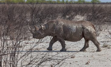
Air Shepherd: Leading Rhinos and Elephants to Safety – With the Help of Drones

Air Shepherd flies drones to stop poaching. To date, they’ve piloted over 4,000 missions to stop rhino and elephant poachers. In their own words, their work is “reversing the march of extinction”. Here’s how.

Wildlife Insights: A Google-Built AI is Taking Animal Surveillance to New Levels

With global biodiversity in crisis, conservationists around the world are devising more and more innovative ways to curb species loss. One of the latest initiatives is Wildlife Insights: a new tool that harnesses the power of AI to dramatically grow our knowledge about wildlife populations.

In Germany, Artificial Intelligence Is Making Wind Turbines More Bird-Friendly

In Germany, the rate of construction of new wind turbines has slowed dramatically - which could have fatal consequences for the energy transition. One of the reasons that new turbines face opposition is that the giant blades endanger near-flying birds. BirdVision is tackling the problem with the help of AI.

Project Zamba: Protecting African Wildlife With Open Data and Artificial Intelligence

Camera traps are often used to protect endangered wildlife, recording thousands of hours of footage of the natural world. But who has the time to watch and analyse all of it? An open data project is helping animal conservation efforts by scanning hours of video footage and automatically highlighting the things that count.

Star Spotting Technology Is Being Brought Back to Earth To Help Save Endangered Species

Technology that was originally developed for finding and identifying stars billions of miles away is now being put to use a little closer to home.

Satellites: Environmental Protectors and Development Aid in Space?

Initially developed for military purposes, satellites are these days being used more and more frequently in the fields of enviromental protection and humanitarian aid, opening up completely new possibilities in the fight against illegal logging, epidemics, environmental pollution and facilitating in monitoring and protecting endangered species. But what do satellites actually do and how is their data used? Can they really be helpful as environmental and development aids?

amur
© Conservation India

Keeping wildlife at the forefront of discussion: an interview with Conservation India

Conserving India’s wildlife is an immense task and one which Conservation India (CI) is fully committed to tackling.