
Content to: Special Feature Satellites and Drones
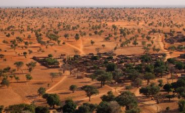
Interview: How Did Scientists Discover Billions of Trees in the Desert?
An international team of researchers, using high-resolution satellite data and artificial intelligence, has been able to locate billions of trees growing in the Sahara Desert. The results were published in the journal Nature in October 2020 - and the discovery made headlines around the world. RESET spoke to research group lead Professor Martin Brandt from the University of Copenhagen to find out more.

Enhancing Food Security Through Earth Science Data
When most agriculture in the world is rural, getting crucial geoscience information to farmers is a technical challenge that a few organisations are just starting to figure out.
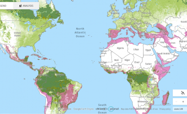
Outer Space for All! Just How Accessible Is ESA’s Satellite Data?
Satellite data not only provides new insights, it can also be an important source of information for environmental and climate activists. But although the data from the missions of major space organisations are freely available, there are hurdles to accessing it. Both ESA and private projects are looking for solutions.
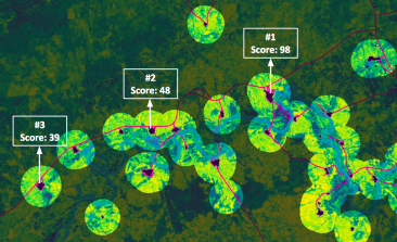
Village Data Analytics: Satellites Help Bring Solar Power to Rural Communities
Many rural off-grid communities would benefit hugely from being hooked up to a solar power system. But which areas are most suitable for solar power installation? And which are most in need? A new earth observation software is using artificial intelligence and satellite imagery to bring power to people more accurately, efficiently and faster than before.
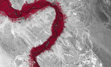
Global Forest Watch Tracks Deforestation in Real Time – And Helps Fight It Too
Global Forest Watch's satellite-based maps provide users with access to data on forests worldwide - and are an important tool in the fight against forest fires and deforestation.
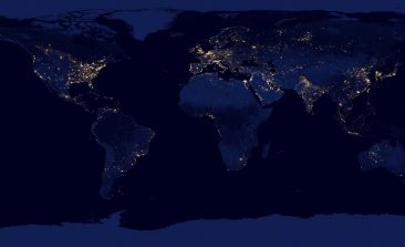
Streetlights Less to Blame for Light Pollution Than Previously Believed
Using satellite imagery and smart city technologies, researchers have discovered the real impact streetlights have on light pollution in our cities.
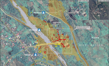
UNOSAT: Using Satellites to Map the Future of Humanitarian Aid
The United Nation’s satellite analysis programme, UNOSAT, uses geospatial information to develop informed, evidence-based solutions to issues of human security, peace and sustainable development.
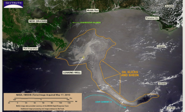
SkyTruth: Using the Power of Satellites to Hold Oil, Fracking and Fishing Companies Accountable
With a focus on oil spills, natural gas fracking and illegal fishing networks, SkyTruth’s work empowers NGOs and members of the public to become environmental watchdogs with a bird’s eye view.
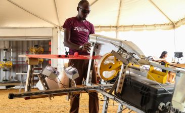
Autonomous Drone Deliveries Provide Life-Saving Services During Coronavirus Pandemic
High-tech drones are providing fast, remote medical delivery services in Africa, Europe and the US - transporting medicines, equipment, blood samples, testing devices and more. And in the midst of the coronavirus pandemic, they're doubling down on their efforts.