
Content to: Satellite
MethaneSAT: A Climate Change Tool That’s Out of This World
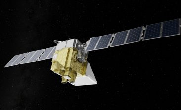
Methane is one of the planet's most dangerous greenhouse gases. A new satellite—the size of a washing machine—is set to provide vital data.
New Satellite Technology constellr Reduces Water Consumption in Agriculture
The constellr satellite system with infrared measuring instrument is intended to help make the irrigation of fields more sustainable.
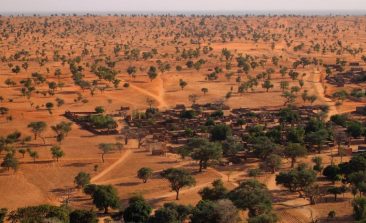
Interview: How Did Scientists Discover Billions of Trees in the Desert?
An international team of researchers, using high-resolution satellite data and artificial intelligence, has been able to locate billions of trees growing in the Sahara Desert. The results were published in the journal Nature in October 2020 - and the discovery made headlines around the world. RESET spoke to research group lead Professor Martin Brandt from the University of Copenhagen to find out more.
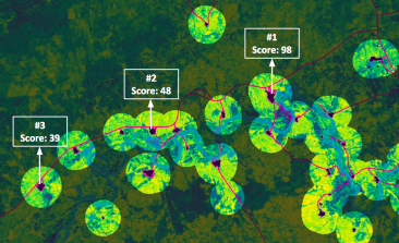
Village Data Analytics: Satellites Help Bring Solar Power to Rural Communities
Many rural off-grid communities would benefit hugely from being hooked up to a solar power system. But which areas are most suitable for solar power installation? And which are most in need? A new earth observation software is using artificial intelligence and satellite imagery to bring power to people more accurately, efficiently and faster than before.
ICARUS: Behavioural Observation of Animals using Mini-Transmitters and Satellites
A satellite-based system for the observation of animals can assist in researching infectious diseases, forecasting natural disasters and protecting species.
German Artificial Intelligence Researchers Hope AI Can Spot Land Damage Before It’s Too Late
Satellites armed with artificial intelligence could act as a high-tech early warning system for environmental damage.
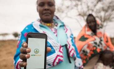
AfriScout: Satellite Technology That Helps Nomadic Shepherds Feed Their Flocks
Climate change and intensive land use are making it increasingly difficult for shepherds in sub-Saharan Africa to find good grazing land. The AfriScout app is designed to help shepherds identify these crucial areas.

How Satellites Can Monitor the Migration of Small Animals
ICARUS tracks the movements and migration patterns of small animals with the help of data chips and satellites. If you’ve ever seen any animals documentaries filmed over the Serengeti, you already know that herds live and roam around the Savannah, particularly gnus, zebras and antelopes.

Drones and Satellites for Good – Satellites Detect Illegal Logging in Myanmar
More than half of the contiguous remaining forests on the mainland in Southeast Asia are found in Myanmar. These forests are home to many species of animals and plants and are a source of food and protection from flooding (among other things) for the local population. Unfortunately, the rate at which these forests are being illegally cleared is increasing.