
Content to: humanitarian aid
New Tracking Technology Hopes to Restore Trust in Last Mile Aid Delivery
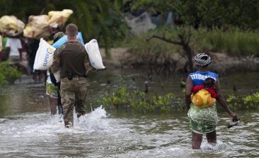
Violence, corruption and infrastructure inefficiencies mean that humanitarian aid delivery is often hindered. Track & Trust hopes to help it along the last mile to those in need.

This Logistics Tool Boosts Humanitarian Aid and Drastically Reduces Costs for the International Red Cross
The International Red Cross provides vital medical supplies to those in need. A logistics tool is enhancing their intricate work, resulting in significant cost savings.
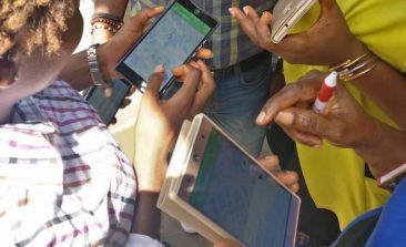
The Community of Thousands of Volunteers Providing Free, Accurate Digital Maps for Humanitarian Response
Digital maps form an essential tool for humanitarian response. A group of mapping volunteers are now working to ensure all crises spots are covered.
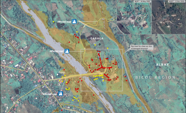
UNOSAT: Using Satellites to Map the Future of Humanitarian Aid
The United Nation’s satellite analysis programme, UNOSAT, uses geospatial information to develop informed, evidence-based solutions to issues of human security, peace and sustainable development.
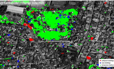
Data4Human: Aid Organisations Get a Helping Hand From the German Aerospace Center
Researchers at the German Aerospace Center are working to make space technologies available for humanitarian aid. The aim of their "Data4Human" project: to provide aid workers with the information they need to make crucial decisions - as quickly and precisely as possible.

Pouncer: The World’s First Incredible, Edible Drone
Forget Foodora and Deliveroo, the most important invention revolutionising food delivery is actually a drone; one that’s good enough to eat.