The importance of fundamental research
It is now widely known that the oceans are severely threatened by numerous human activities. Environmental disasters, dumping and overfishing are just some examples. This leads to species threatened with extinction, destroyed environments and the threat to the oceans as a source of human food and livelihood.
Poorly managed work in the field of nature conservation is often ineffective and, worst case, leads to additional damage. The best way to ensure environmental protection is to thoroughly collect ‘basic data’ — the fundamental observational data needed to understand a topic — in advance, evaluate it professionally and develop successful long-term conservation projects based on its findings. Afterwards, the results can be compared with previous data, meaning the success of the conservation project can be statistically evaluated and, if necessary, adjustments can be made.
In addition, many key observations about nature including data on cycles, interactions and interrelationships, as well as complex problems and the measures taken against them, are often only reflected accurately in data after a longer observation period. Basic research is therefore usually designed for the long term.
Rügen’s data buoy is deployed
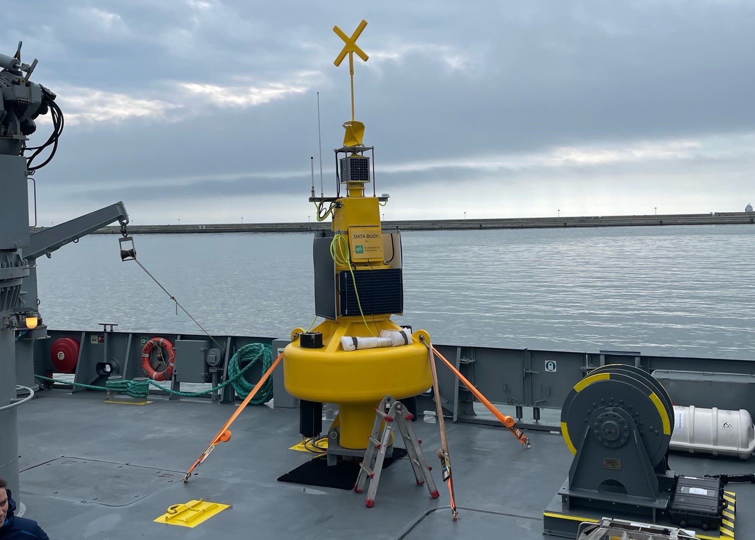
The Federal Agency for Nature Conservation has developed a floating measuring station with various sensors for marine research at about four metres high and weighing 900 kilograms. The so-called data buoy has the task of recording hydrological and meteorological data such as temperature, turbidity and oxygen and salinity levels, as well as documenting the occurrence of harbour porpoises and bats. Data on shipping traffic and noise pollution within the protected area are also collected. According to Corinna Bertz from the Federal Agency for Nature Conservation, further sensors are also being developed. In the future, for example, it should be possible to measure CO2 and methane concentrations and “contribute to assessing the state of the oceans as a result of climate change and the possible contribution of the oceans to the storage of greenhouse gases such as CO2 and methane”.
Part of the information is transmitted from the data buoy in real-time and without interruption via satellite and GSM connection to the Agency. “The results — as long as they are not subject to secrecy — are available to all research institutions and the public”, explains Corinna Bertz. The first findings are expected to be available in autumn 2023. More data bins will follow in other marine protected areas.
Strengthening marine protected areas through basic data
The recorded data provides essential information about the state of the environment. In the future, biological and oceanographic monitoring will serve as a scientific basis for sustainable area management. To this end, the collected data will be incorporated into nature conservation and political decisions, playing a decisive role in determining the type of conservation measures. This is to ensure that the protected areas are safeguarded in the long term.
“Marine protected areas are important instruments for the protection of the oceans. It is important to strengthen management in the existing protected areas. The new measuring stations will provide the necessary environmental data for this”
says the Federal Government’s Commissioner for the Marine Environment, Sebastian Unger, about the project.
In addition, the open data approach of the project enables an interdisciplinary exchange with other research institutions. The public is also involved in the project, which should lead to more acceptance and increasing interest in marine conservation.
As individual information on an area is documented by the data bin, tailor-made recommendations for action can be derived from it for problems occurring on-site. This increases the conservation project’s chances of success. For meaningful and successful long-term marine protection, sound basic research with a lot of data is needed — observe first, take targeted action after is the motto!