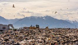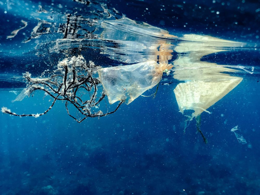
Halfway between Hawaii and California lies the Great Pacific Garbage Patch. As the name suggests, the GPGP is a giant area of waste in the middle of the Pacific Ocean. Consisting of 1.8 trillion pieces of plastic, the area is the single largest accumulation of plastic waste in the world’s oceans.
Climate scientists have long been tracking plastic pollution and investigating the impact marine litter has on ocean biodiversity. The WFF has even created an interactive map that visualises plastic pollution. The map is drawn up using data from scientific publications.
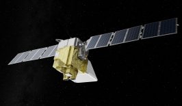
Local surveys and on-site observations are also commonly used to measure plastic waste, but these approaches aren’t able to track every piece of litter. They’re also time-consuming and expensive, without the ability to easily track data worldwide. Now, scientists are looking at the potential of satellites to take long-distance views of our ocean waste and track marine litter from space.
From measuring ocean and air pollution to monitoring and preventing illegal deforestation, there are many ways satellites can help protect our planet. A key player in the field of data collection, now supported by AI systems, satellites are crucial in helping us measure the impact of climate change on the earth. Satellite disposal remains an issue, however, with debris littering space and raising ethical concerns. Read more about the potential of satellites in the field of sustainability in RESET’s Special Feature.
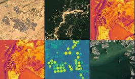
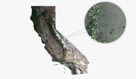
Satellite images are turned into a map of marine litter
New research published in June 2024 explains how scientists used existing satellites to detect evidence of waste in our oceans. They tasked supercomputers and advanced search algorithms with analysing 300,000 satellite images and drew up a corresponding map of marine litter. This map is now the most detailed record of ocean waste that exists.
The research study was carried out by a variety of institutions across Europe. Meanwhile, the German research facility MI4People is another organisation intending to use satellites for marine litter detection. They are currently in the first phase of their project which involves creating a machine learning model based on public data. As well as tracking marine litter’s density and location, the model will also be able to classify the litter. Once it’s complete, MI4People intends to make its platform open source to support organisations and researchers who would benefit from marine litter data, as well as ocean clean-up organisations.
Satellites can help preserve our oceans
Having a detailed record of exactly where plastic waste is in the ocean is just the first step in protecting marine ecosystems. It’s then over to ocean-clean up organisations to remove marine litter from beaches and oceans. While these organisations may be the ones taking action, it’s also crucial that governmental bodies and politicians create supporting policies. For example, the UN partnered with The Ocean Cleanup to commit to reducing plastic leakage into marine ecosystems. As for individuals, volunteering for beach litter picks or donating to these organisations can go a long way to help. UK residents can search for a local beach clean-up to join here. And above all, the most effective way to reduce the harm of plastic on the oceans is to cut down on plastic and avoid creating plastic waste at all.
At RESET, we’ve reported on how satellites can aid with everything from monitoring our climate to reducing water consumption in agriculture. Viewing the ocean from space via satellites could also have other use cases. Satellites could identify oil spills or help with search and rescue missions. With ocean health directly impacting human health, protecting our marine ecosystems will have long-term benefits for us all.