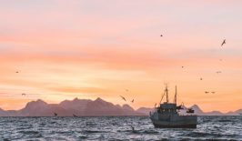
In 2015, the Patagonian coast of Chile experienced one of the largest strandings of whales in recent history. Once the investigators had arrived at the remote fjord – at least a month after the actual event – they observed the remains of around 343 sei whales scattered throughout the area. Although this figure was high for a whale stranding, especially for the sei whale which tends not to strand in large groups, more recent research using satellite technology suggests the real figure could have been twice as high.
It is now hoped the technology could one day be used to provide a rapid response force for future whale strandings. Although it is unlikely it could be used to actively save stranded whales, it would give researchers the ability to better investigate and research the phenomenon and help them to better understand why it happens.
What is a Whale Stranding?
 A mass stranding of Blackfish on the shore of Cape Cod, Massachusetts around the turn of the 20th century.
Cetacean stranding, better known as beaching, refers to whales and dolphins becoming stuck on beaches and coastal land with no ability to escape. Strandings can occur with a single whale, but the more dramatic versions can include up to hundreds of whales and dolphins becoming stranded at the same time.
Strandings have been reported since the beginning of written history, and in many ways they can act as an important part of the ecosystem, with whale carcasses providing a vast food source for a wide range of animals. However, the exact causes for them are not fully understood.
Although natural causes likely play a major role, researchers are eager to discover if manmade environmental changes, such as rising sea temperatures, have also had an effect on the frequency of strandings. In reality, some strandings may actually be dead whales simply washing up on shore, however the tight social groupings of toothed whales means that large scale strandings are likely the result of other complex stimuli.
Whales can potentially be saved during a beaching, especially in small-scale incidents and near public areas, but often they result in death, either due to dehydration, collapsing under their own weight or drowning once tides rise.
How Does Satellite Technology Help?
Strandings can occur all over the world, with many of them likely going unrecorded in remote areas. As an estimate, it is suggested around 2,000 whales and dolphins become stranded on land each year. Even when strandings do occur near human populations, it can often be weeks before investigators and researchers can arrive to conduct a survey and autopsies. By this point, some carcasses may have washed back into the sea or become too decomposed to provide accurate information.
In the Chilean case, the stranding was only discovered by accident and the first researchers arrived likely a month after the actual event. Once on site they had to resort to slow and laborious manual methods of navigating the difficult terrain via planes and boats and counting the remains of whales – often using expensive aerial surveys. Dr Jennifer Jackson of the British Antarctic Survey (BAS) explained the issues with the original investigation methods, explaining to the BBC:
“The aerial survey was done on a huge scale and was very impressive, but it’s possible some of the carcasses got washed back out to sea in storms and simply weren’t counted. The 343 number was only ever a best estimate.”
The 2015 Patagonian stranding, however, was used to test Very High Resolution satellite (VHR) imagery and investigate how satellites could be used to better detect and record remote whale strandings in the future. The test, carried out by the BAS and Chilean organizations, used images from the WorldView-2 satellite that were taken at the time of the whale stranding. In the investigation published in the Plos-1 journal, the team used two photos from mid-March to investigate not just the scale, but also the chronology of the event. The first photo reveal slightly fewer whales than they had seen with the aerial survey, while the second picture showed significantly more – around twice as many as the 343 originally counted. This means that the scale of the incident was originally vastly underestimated.
The WorldView-2, in particular, is able to make out in great detail increasingly small features and identify individual objects larger than 50cm at an altitude of 700km. Whales, therefore, are certainly large enough to be visible through its images, although later versions of the WorldView satellite system will boost this to 30cm – perhaps making identification of specific species easier.
For now, the technology will be best used to investigate known cases of beachings, likely weeks after they have occured, but in the future, combining satellite imagery with artificial intelligence image recognition software could greatly improve reaction time.
Currently, humans are needed to search for specific images from known strandings. If a machine could take over that work, it could scan thousands of images in the fraction of the time and reveal whale strandings that would have gone unnoticed or that might even be in process. Whales, due to their size and often distinctive shapes and colours provide a good overall shape which artificial intelligence software could learn to identify – meaning they could be able to spot strandings much quicker than a human.
So far the team has taught a computer to recognise the light signature of the dead whales in the Chilean incident – which turned pink and orange as they decomposed. Although the algorithm is currently less accurate than a human, it is expected to improve in time. It could in the future be used to monitor whale stranding prone areas – such as New Zealand, the Falkland Islands and Patagonia – as well search remote, lesser known, locations. Doing this with human teams would be impossible for practical, logistic and financial reasons.
How Does This Benefit Whales?
Satellite imagery could be a useful tool for estimating local populations as well as uncovering more information about whales’ life cycle, social structures and dietary habits.
As mentioned above, whale strandings are still somewhat of a mystery for researchers and are likely caused by a wide array of issues. The Chilean case, for example, was probably due to the whales ingesting poisonous algae. But, there is also speculation that human interference, including the use of underwater sonar and climate change in general, could also play a role in some cases.
By arriving at the site of a stranding rapidly, researchers can conduct more accurate and timely autopsies as well as better access local environmental and oceanic conditions. This greatly increases the potential for research and for the discovery of environmental factors and possible degradation that might be having a negative affect on whale populations.