Peatlands are perhaps an under-appreciated, but vitally important, natural carbon sink.
It has often been said that the world’s tropical rainforests are the “Lungs of the Earth” – highlighting their important role as a carbon store. However, there is another type of environment which may be even more deserving of the moniker – bog and peatlands.
Bogs, peatlands and other types of wetlands also play a central and important role in carbon sequestration. In fact, although they cover only around three percent of the world’s surface, they store more carbon than all the other vegetation on Earth combined and are second only to the oceans in terms of an overall carbon sink.
However, until recently, the role played by these important environments has been overlooked, underappreciated and understudied. Now, a new satellite programme hopes to reveal exactly how bogs – at least those in Scotland – ‘breathe’.
Teams from the University of the Highlands and Islands, the University of Nottingham, and Forestry and Land Scotland, in conjunction with NatureScot, plan to use Satellite Interferometric Synthetic Aperture Radar (InSAR) to map shifts and movements in the surface of bog and peatland in Scotland. By observing the bogs from above, the team hopes to better understand the influences which affect bog ‘breathing’, such as precipitation, water level, vegetation composition, micro-topography and land management.
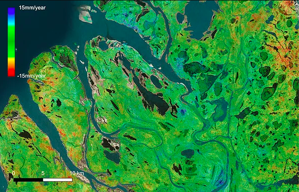
The imagery, provided by the European Space Agency’s Sentinel-1 satellite, will be combined with unique technology from Terra Motion, a land motion survey spin-out company of the University of Nottingham. They have developed APSIS (Advanced Pixel System using Intermittent SBAS), a system which allows minute shifts in land – from millimetres to centimetres – to be discerned from satellite imagery
Usually, such changes would be incredibly difficult to observe with the naked eye or measurements on the ground, especially considering the difficulty entailed in working and traversing bogland. Armed with this information, researchers hope they could pinpoint the areas of bogland under threat and assist in more accurate restoration work.
Peatlands Under Threat
Peat is essentially decomposing plant matter which has been trapped in an oxygen poor environment, such as waterlogged wetlands or swamps. In these conditions, vast amounts of carbon can be stored and contained by bogland, which is released when the peat makes contact with oxygen. As a result, maintaining and protecting peats could be a vital method of containing carbon emissions.
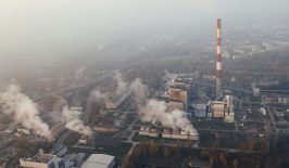
Traditionally, however, peat bogs have been seen either as a resource for exploitation, or as a natural obstacle to be drained. Peat is extracted by various industries, and is removed as a fuel or as an ingredient in agricultural and gardening compost. Elsewhere, it is drained to produce often highly fertile farming land. But, all of these activities also release carbon. According to the IUCN, the destruction of peat bogs contributes about 10 percent of greenhouse gas emissions from the land use sector, accounting for an estimated 1.3 gigatonnes of CO2 annually. Currently around 15 percent of all global wetlands have been drained or destroyed.
This damage also has additional environmental impacts. The draining or reduction of peatland also damages biodiversity, increases fire and flood risks and worsens the quality of drinking water.
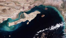
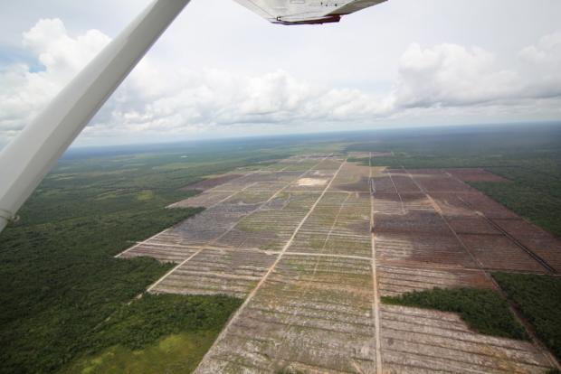
National governments and international bodies, such as the United Nations Food and Agriculture Organization, are increasingly introducing programmes and legislation to protect the world’s remaining peatlands. For example, in the UK, the government aims to ban peat as an ingredient in amateur gardening compost by 2024, as well as restore around 35,000 hectares of peatland. Elsewhere, however, its destruction continues. In Indonesia, peatland has been cleared for the creation of palm oil plantations (pictured above).