
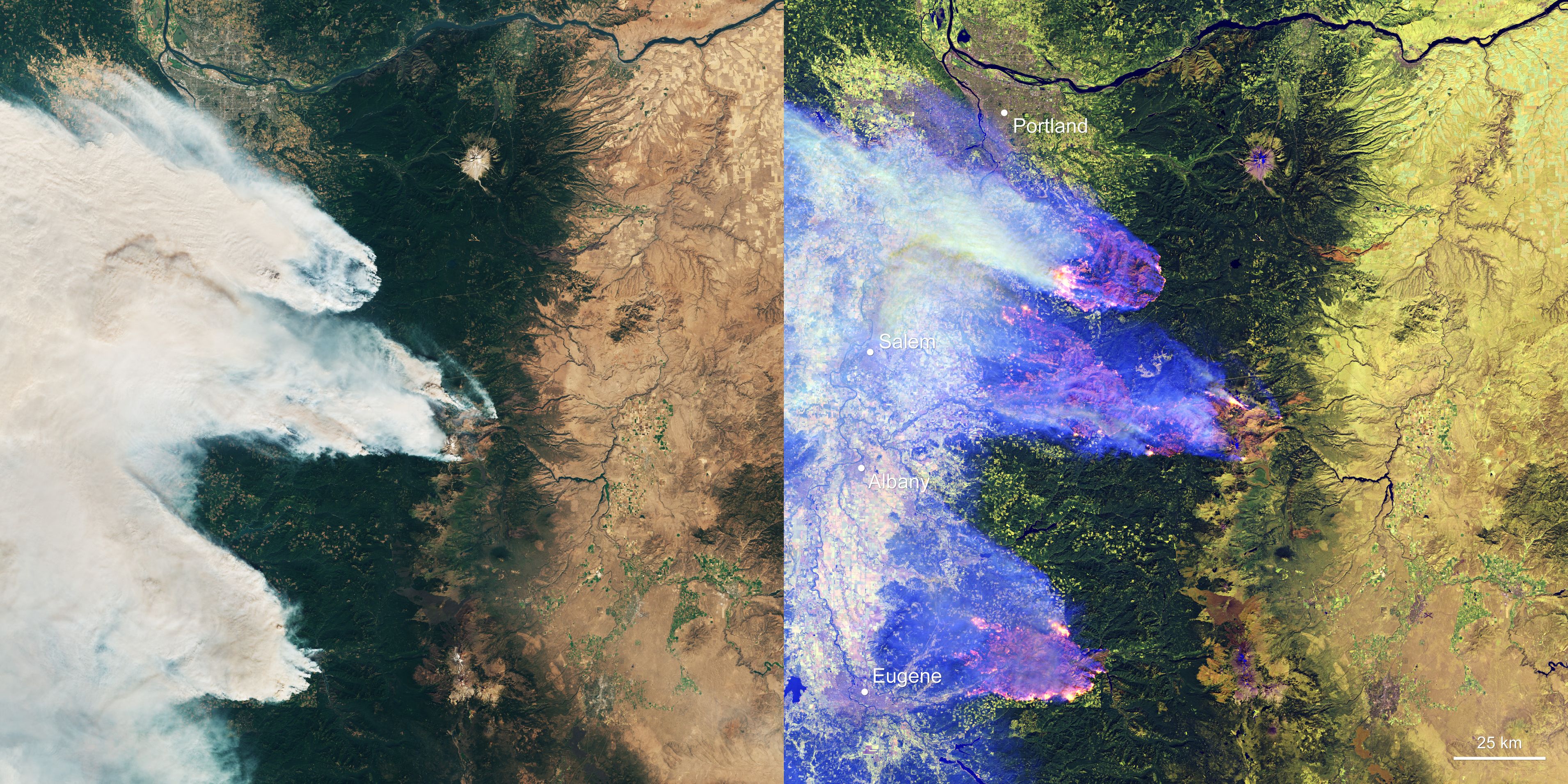
A few months ago, the discovery of eleven previously unknown penguin colonies made headlines. They had been found by the Earth observation satellites Sentinel-2 of the Copernicus mission of the European Space Agency (ESA). Shortly afterwards, researchers scanning satellite images discovered an unexpectedly high number of trees (1.8 billion and counting!) in one of the most arid regions of the world.
Very few of us will ever see the world from an astronaut’s point of view. But all of us, today, have a more accurate picture of our home planet than ever before, because satellites are constantly transmitting images and data down from space – and delivering new insights.
It is hard to imagine our everyday lives without much of the information and services provided by the Earth’s satellites. “Half of the apps on our smartphones are related to data from space. That’s everything from television broadcasts to phone calls to weather forecasts and, of course, navigation,” Holger Krag, who heads the Space Security Programme at the European Space Agency (ESA), explained to RESET in an interview.
Rapid developments in the space industry
In March 2020, there were nearly 2,700 satellites orbiting the Earth at altitudes between 300 and 36,000 kilometres – and because the space industry is currently experiencing rapid growth, the number is growing almost daily.
For decades, constructing satellites, which often weigh more than two tonnes, and transporting them into space was so complex and expensive that only a few space organisations and companies were able to get involved. But now small satellites, such as the cube-shaped “cubesats”, are conquering the skies – thanks to miniature circuits, high-resolution mini-cameras, increasingly powerful batteries and solar cells. These mini satellites are usually more limited in their capabilities, but they weigh only a few kilograms and are proving incredibly versatile.
These kinds of lightweight satellites can easily be transported into space in large quantities; the American company Planet Labs, for example, has put 331 Earth observation satellites into orbit since 2014, 150 of them in 2018 alone, each satellite barely heavier than 5 kilo. And SpaceX, the space company led by Elon Musk, plans to launch thousands of satellites into orbit over the next few years for a global satellite network. The company has received temporary permits to launch 11,927 satellites by 2027 and has filed applications with the Federal Communications Commission (FCC) for up to 30,000 more.
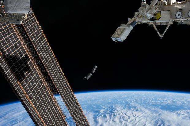
Many satellites nowadays hitch a ride into space, with many rocket operators selling “ride-along” opportunities when they launch large satellites or other space missions. This minimises launch costs enormously and is a gateway into space, especially for smaller satellite operators. In addition to SpaceX, startups like Rocket Lab are also working on making the transportation of satellites with small, new types of rockets even cheaper.
These developments have been made possible not only by new technologies, but also by an opening up within the space industry: “The decisive wave came when NASA and then the other government agencies in America turned to private providers,” says Marco Fuchs, head of the Bremen-based space and technology company OHB. “The traditional industries were obviously not dynamic enough. There was no competition. Meanwhile, NASA and the Air Force, which launches all the military satellites, opened up. They were willing to invite Elon Musk, and also others too, and in the end even start awarding contracts.”
Satellites on a mission to save the planet
These recent developments in the space industry have also created fresh momentum among research institutions, startups, NGOs and other civil society actors.
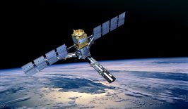
Satellites equipped with state-of-the-art camera equipment can provide never-seen-before images of the Earth, allowing researchers to scan and image vast areas in an instant. Researchers at the Federal Agency for Cartography and Geodesy are taking advantage of this in the Cop4SDGs project by using satellite remote sensing to capture and better verify sustainability indicators.
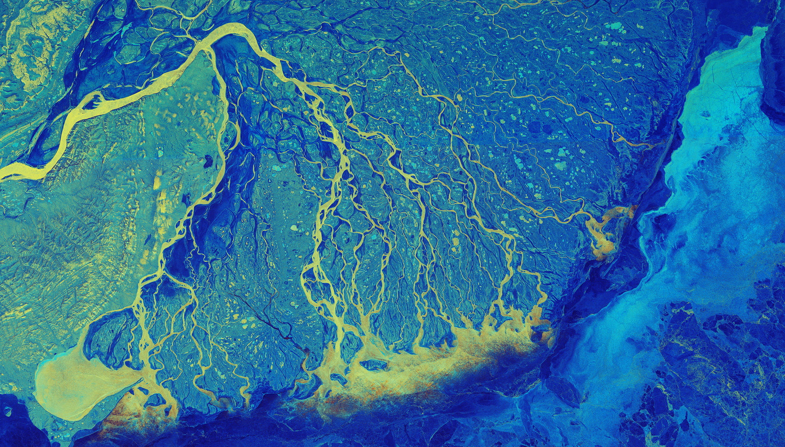
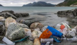
Thanks to their special equipment, satellites can now also measure things that are invisible to the human eye, such as air and ocean pollution. For example, ESA’s Sentinel 5P satellite, launched in 2017, has instruments that can measure various pollutants in the Earth’s atmosphere. Both NASA and ESA, in their SMOS (Soil Moisture and Ocean Salinity) and Aquarius programmes respectively, use these findings to measure ocean acidification from space. And in a paper published in Nature Scientific Reports, a research team outlined how high-resolution satellite imagery can even be used to detect and identify “macroplastics” (plastics five millimetres or larger) in seas and oceans.
But it is not only the publicly available data from the satellite missions of major space agencies that provide new insights into environmental and climate protection, but also new types of mini-satellites: The US company Bluefield has developed a technology that combines satellite technology and optical methods to detect methane leaks. Their satellites, the size of a backpack are equipped with optical sensors, are collecting data on methane emissions worldwide. And Planet’s satellite imaging specialists have launched around 175 miniature satellites that can provide various organisations with up-to-the-minute, high-resolution images on an unprecedented scale to prevent illegal deforestation and other environmental damage.
Drones – protecting animals and planting trees
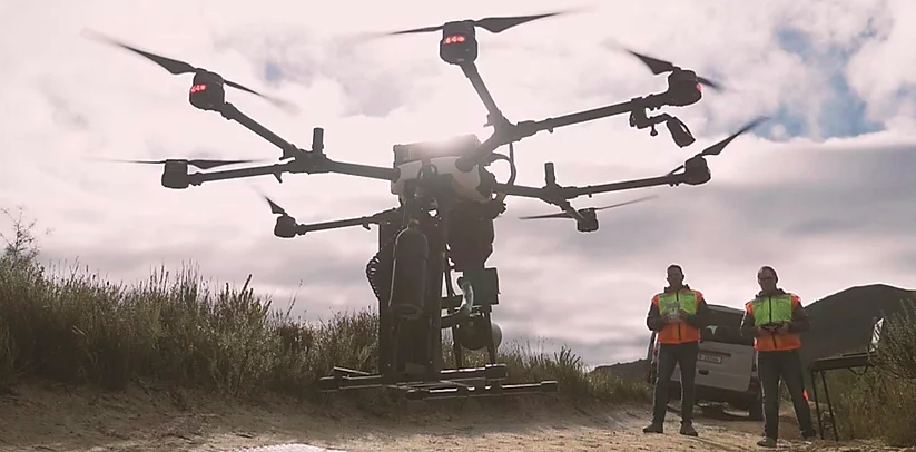
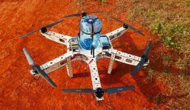
Another autonomous flying object is also currently enjoying a new lease of life as a protector of the environment and a weapon against climate change: drones. While satellites are particularly suitable when it comes to earth observation, providing a “big picture” overview of large areas, drones zoom in even closer – and can, for example, play a role in protecting endangered animals in Africa’s savannahs from poaching. And in contrast to satellites, who look down on the world passively from outer space, drones can actually intervene in goings-on on the ground, for example by being used as seed planters and in reforestation efforts.
Use of artificial intelligence drives development forwards
As these examples show, satellites and drones provide us with crucial insights into the state of our planet and allow us to carry out more targeted actions for the good of the environment and the climate – both by giving us a more complete picture and by recording information about individual areas in great detail. But much of the data that reaches us each day from space would be of little use without another further development: the rapid advances taking place in the field of artificial intelligence (AI).
Sifting through, selecting and evaluating the flood of high-quality satellite images and information is an enormously time-consuming task and impossible to manage effectively using only human workers. However, AI systems can be trained to recognise specific structures in satellite images, processing vast amounts of data in a very short time. One example is the OpenSurface project, which offers an AI-based solution for monitoring land use from space. By intelligently merging vast amounts of land use data from, among other things, satellite images, OpenSurface is allegedly able to monitor – and even forecast – deforestation, land changes and forest fires.
Space debris – low earth orbit quickly filling up with discarded spacecraft
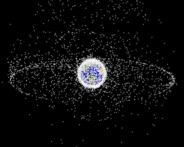
Today, there are around 3,000 inactive satellites orbiting the Earth – and more and more space debris is accumulating in low-Earth orbit. “This is because the objects sometimes remain in space forever. That is the real problem. With many environmental problems on Earth, time helps us solve them. So toxins decompose and so on. But in space, we have to deal with very long residence times,” says Holger Krag. While objects in lower orbits are virtually “pulled” into the Earth’s atmosphere due to gravity and burn up there, it’s different at higher altitudes: “If we leave something at an altitude of 1,000 kilometres, where there are no natural forces to break down the object, then it will remain there for all eternity.”
On top of this, satellites and other things humans have left in space continue to break down further due to collisions – and the tiny pieces of debris that result from those collisions continue to travel in orbit. “You can say that we have about 20,000 pieces in orbit around the Earth that are bigger than a softball and more than 500,000 pieces that are up to the size of a marble. That is quite simply a vast number,” reports Sven Bauer, who heads the so-called SLR station at the German Research Centre for Geosciences (GFZ), in Potsdam, which monitors space debris. “If you consider those small pieces that are up to the size of a marble, even those are of critical importance, because they’re flying around up there at speeds of up to 28,000 km/h.” At this speed, even the smallest impacts and collisions can result in huge amounts of damage – and even more pieces of space debris.
Not only do discarded satellites and other objects endanger space travel and other satellite missions, but from a sustainability perspective, it raises the issue of whether its ethical for us humans to be treating space as a dumping ground for our space experiments.
Satellites + sustainability
Space travel and everything associated with it still holds a special fascination for many people – whether it’s the great unknown, the infinite expanse – or the idea of being able to look down on your home planet from above. Is it in fact this “view from above” perspective” that gives satellites such huge potential when it comes to protecting the planet?
In our RESET Special Feature “Satellites for Sustainable Development”, we’ve set off on a journey to find the answer – interviewing experts and exploring a whole range of real life case studies. You can find all of the articles in the series right here.
This is a translation of an original article that first appeared on RESET’s German-language site.


