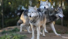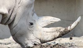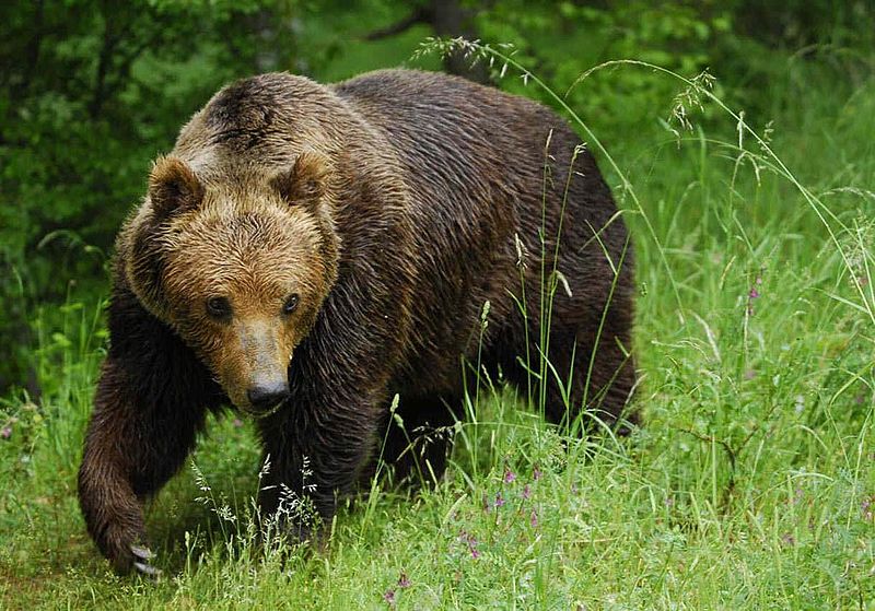
In recent years, many European nations have explored ways of restoring their populations of large carnivorous animals, such as wolves in Scotland or bears in Italy. Bringing back these creatures, long persecuted by humans, could play a role in reestablishing equilibrium within ecosystems. However, doing so is not without controversy. When these large animals cross paths with their human neighbours, conflict and trouble is often not far behind.
With this in mind, a coalition of research institutes are looking at ways of keeping these groups apart. Key to understanding this, is first discovering where these big animals roam and call home. Researchers from the German Centre for Integrative Biodiversity Research, the Friedrich Schiller University Jena, Aarhus University and the University of Oxford have developed a new open source software dubbed ‘Enerscape’, which provides an innovative twist to previous methods of animal monitoring.
Traditionally, in order to develop a map of animal movement, individual animals would need to be located, sedated and tagged with radio transmitters. This would provide telemetry data on the animal’s movements, eventually allowing researchers to compile a map of its travels. However, this type of mapping is often time consuming and expensive. Full maps are only provided once the animal has actually travelled the distance, which could take entire seasons, while it also requires interaction with the animal itself, requiring expert personnel and equipment.
The Enerscape software uses a different approach. Instead of physically tracking individual animals, it provides a calculated predicted route animals such as bears are likely to take. It does this by using ‘energy’ as the basis of its calculations. All movements requires energy, and generally speaking, animals will often take the route which requires the least expenditure of this precious resource. Enerscape is able to create ‘energy landscape maps’ by calculating the amount of energy – based on factors such as animal weight and movement behaviour – that would be required by a particular animal to travel a certain distance. This energy expenditure is then integrated with the topographical information of an area to create maps of likely travel. One of the huge advantages of the system, is that it requires very little initial data to compile a map.
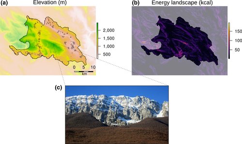
The research, published in the Methods of Ecology and Evolution journal, is largely based on a trial conducted in the Abruzzo region of Italy, which is home to the endangered and protected Marsican brown bear. Tracking the bears’ movements in the 50,000-hectare Sirente Velino Regional Park using telemetry was proving difficult due to the park’s scale, the elusive nature of the bears and rugged terrain which prevented radio signals. However, by using the Enerscape software, researchers could predict the likely route of bears and hopefully prevent clashes with humans – which often result in fatalities for the bears. In particular, it predicted the bears would prefer to preserve energy by remaining in valleys.
The software is developed from the widely used ‘R’ programming language, which features an easily adaptable modular structure. It is hoped this accessible and open source approach can lead to widespread and varied use of the tool. Professor Fritz Vollrath from the Department of Zoology at the University of Oxford and senior author of the study said:
“This makes it possible for both researchers and wildlife managers to adapt the software to a wide variety of landscapes and animals. This means that the number of maps of animal movement in landscapes will increase in just a short time. With significantly more cartographical data, the understanding of the behavioural ecology of a species in a certain habitat will also fundamentally change. This will primarily benefit nature conservation and, in particular, rewilding measures – the reintroduction of wild animals.”
Back to Nature
Originally developed in a theoretical sense in the 1960s, the concept of ‘rewilding’ gained traction in the 1990s. Simply put, rewilding is a more passive approach to conservation and involves humans stepping back from an area and allowing millennia old natural processes to be restored. In some cases, this will also involve the reintroduction of animals previous depleted by human activity, most commonly apex predators such as wolves, lynx and bears.
Many of these species had been rendered extinct in certain areas due to aggressive hunting by humans wishing to protect their livestock. However, this would go on to have other side effects for biodiversity. For example, a lack of predators results in overpopulation of prey animals who then overgraze certain areas and spread disease. In previous years, humans then assumed the role of wolves and bears, however the decline in hunting for sport and recreation has allowed populations in some regions to explode. One notable example is red deer in the Scottish highlands, which have been compared to a ‘plague‘ in some reports. One of the current management methods is frequent and extreme culls, but it is hoped wild predators can be reintroduced to once again play their natural role.
But rewilding is not without controversy. Farmers in particular are concerned predators will simply target their livestock, which will be much easier to locate and hunt. Some conservationists also question the impact of reintroducing large animals, which will place additional pressure on ecosystems and perhaps negatively impact other endangered species.
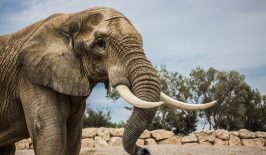
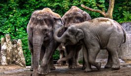
Ultimately, the success of rewilding efforts may largely depend on keeping animals and humans separate. Technology, such as remote sensing and data-driven maps can certainly pay a role in this regard, and allow locals and researchers to identify potential conflict areas. Perhaps lessons could be learned form recent efforts in China. For example, in the semi-tropical Yunnan province, rangers looking to protect the region’s Asian elephants have used sensors and mobile phone apps to create an early warning system for locals, who often use the same paths as the elephants. However, the project goes even further to defuse human-animal conflict. Farmers themselves have been deputised as rangers to care for the elephants, while the government pays reparations for any damage done to their crops by herds. If rewilding is to continue elsewhere, governments and conservationists must also be careful not to recreate the very same negative relations between predators and human which led to the demise of the the former in the first place.