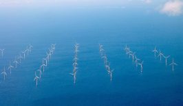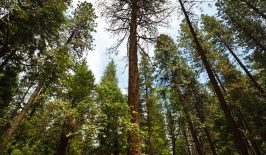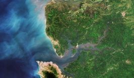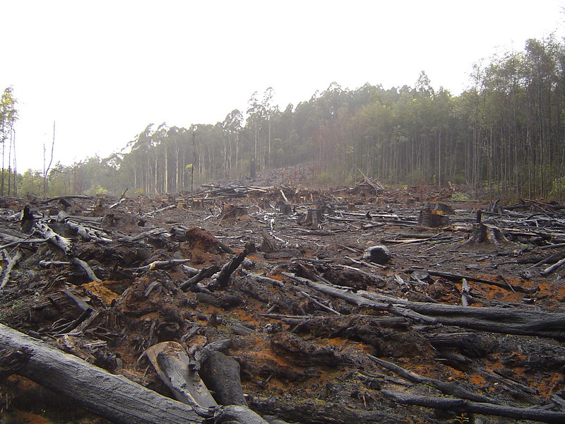
Land use is a climate change issue. Agriculture, forestry, and land clearing are responsible for around a quarter of global greenhouse gas emissions. If we are to meet the global emissions targets set by the Paris Agreement and keep global warming under 2℃, these emissions need to be reduced as much as possible: by better protecting native forests, containing urban sprawl and ensuring that land-based economic activities such as agriculture are carried out as sustainably as possible. But how can we best keep the use of land in check? And when rules and regulations are brought in to make land use more sustainable, how can we ensure that they are being followed? Monitoring land use over large areas is resource-intensive and complex, with huge amounts of data coming in from different sources, including government records, measurements carried out on the ground, and satellite and drone imagery collected on different dates, from different altitudes and at different resolutions. Now, developments in machine learning could help us make sense of all this data and put it to good use.
A recently launched, AI-powered platform called OpenSurface wants to help governments, companies and researchers track, monitor and evaluate land-use change in a swift and efficient way. By intelligently aggregating huge amounts of land use data from diverse sources, OpenSurface claims to be able to monitor (and even forecast) deforestation, subcanopy change and wildfires, evaluate present and future biodiversity levels and track and project crop and soil conditions over time.
Their Application Programming Interface (API) incorporates various technologies, including machine learning, secure ledgers, remote sensing, and the internet of things – combining them to provide customised and digitised land management services. The AI helps the system classify land use and land cover and analyse decades of spatial imagery quickly and with more accuracy than previous techniques. While using high-quality drone images, these technologies are even able to measure the different tree species present in forests – and their carbon sequestration potential.
David Dao, from ETH Zurich’s DS3Lab, supports the platform from the AI research side. “What makes OpenSurface intelligent is the way we are forecasting deforestation,” he explains. “In our research, we are aiming to leverage cutting-edge machine learning to predict risk areas of deforestation from raw satellite imagery. This enables us to, in theory, scale to daily predictions. Nowadays, satellites can take one image per day from most of the places in the world.”
OpenSurface predicts deforestation with a video prediction model that uses remote sensing to detect deforestation patterns by sequencing images in chronological succession. These patterns allow users to detect upcoming deforestation threats. By combining this information with government data on zoning and land ownership, policy can be implemented more effectively to stop it. This is just one of the artificially-intelligent tools that DS3Lab has developed to curb deforestation.
The platform could, in the future, be used to help streamline results-based payments – by efficiently gathering evidence on how well forests have been protected and maintained. The results-based payments strategy, developed by REDD+ – the United Nations program on reducing emissions from deforestation and forest degradation – provides financial incentives to emerging economies that have halted deforestation during a period of time. For example, the Green Climate Fund made a payment of USD 96.5 million to Brazil in 2014 and 2015 for stepping up efforts to halt deforestation of the Amazon.
A Pilot Project Tackling Deforestation in Chile
OpenSurface’s first pilot application is taking place right now in Chile in collaboration with Chile’s National Forestry Corporation (CONAF). They’re currently developing and fine-tuning the technology in order to use it to compare planned and authorised land uses against actual forest depletion levels on the ground. Whenever there is a difference between the authorised land use and the real land use identified by the technology, OpenSurface sends an alert to staff at CONAF. According to the head of CONAF’s Climate Change and Environmental Services Unit, “the OpenSurface platform will be an important tool to reduce deforestation, and particularly forest degradation – the main problem affecting native forests in Chile.”
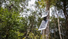
With OpenSurface, CONAF aims to demonstrate positive forestry outcomes and help Chile achieve its natural capital and climate commitments. It’s not the first time that CONAF has employed innovative technologies to stop deforestation. In the past they have installed smoke detectors in forests that alert them when there is a forest fire, and solar-powered audio sensors that can distinguish chainsaw noises from normal forest sounds in order to alert park rangers about illegal logging.
A huge multi-partner international initiative gave rise to OpenSurface, which includes IDB Lab, EIT Climate-KIC, Cleantech21, South Pole Carbon Asset Management, ETH Zurich’s DS3 Lab, and Scout Impact R&D. They collectively launched the OpenSurface platform at the COP25 in Madrid last December. Although the COP25 was a disappointment in terms of international agreements, it did prove to be a successful showcase for global climate action, such as programmes and technologies like OpenSurface.
The intelligent OpenSurface platform can make land monitoring easier, faster and more accurate. And because it is open source, it can be used by a wide range of stakeholders to protect land-based natural resources—not limited to forests, soils and ecosystems—and reach our global goals on climate action. As David Dao from ETH Zurich’s DS3Lab explains, in the future, this system could also be used to track urban land use so as to ensure sustainable city development: “In theory these problems are all very similar and one algorithm could use something which we call ‘transfer learning’ to quickly adapt to another problem domain. We haven’t worked on urban problems yet, but I’m sure we will look into this in the future.”
This article is part of the RESET Special Feature “Artificial Intelligence – Can Computing Power Save Our Planet?” Explore the rest of our articles in the series right here.