There was once a time when conservation research meant lengthy treks into the wilderness, sitting in camera hides for hours on end and tracking elusive endangered animals through tricky terrain. However, new technologies are allowing biodiversity researchers and conservationists to gain access to the data they need with increasing ease and convenience.
In fact, these days you don’t even need to see an animal to know it’s there. Environmental DNA (eDNA) refers to traces of cellular material left by animals — for example, via skin contact or excrement — which can be sampled directly from the environment and studied. These traces can be used to develop profiles of ecosystems to ascertain the numbers, frequency and even health of animal species.
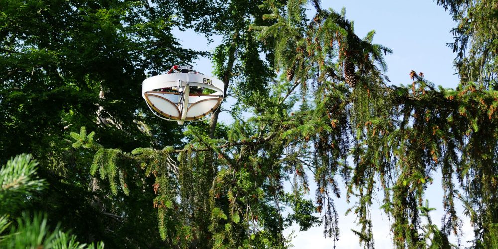
But, collecting eDNA samples still poses its challenges. Although obtaining samples from soil and water is relatively straightforward, other habitats — such as the forest canopy — are tougher for researchers to access. With this in mind, ETH Zurich and the Swiss Federal Institute for Forest, Snow and Landscape Research WSL, in cooperation with eDNA experts SPYGEN, have developed a specialised drone capable of grabbing eDNA from the treetops.
The drone, which can function autonomously, is equipped with adhesive strips for collecting eDNA material from leaves and branches. However, it’s more than just a drone wrapped in sticky tape. The device requires some pretty advanced software to be able to navigate and safely land on a wide variety of branches and trees. Therefore, the drone has been equipped with sophisticated programming and a force-sensing cage to better allow it to measure local factors and make adjustments accordingly.
Once collected, the trace DNA is digitally amplified, sequenced and then matched to known profiles of local animals. With this data, accurate assessments of local wildlife can be made.
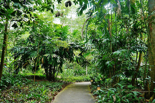
The design was tested out on seven different tree species in Switzerland, which has revealed the profiles of 21 distinct groups of birds, mammals and insects. To further test the drone’s abilities under more tropical conditions, the drone has also been used in Zoo Zurich’s Masoala Rainforest enclosure. Not only does this allow the drone to be tested among different flora, but it has the added advantage of providing a closed, stable testing environment. Since it is already known which animals are in which enclosures, the drone’s accuracy and thoroughness can be better evaluated.
Much of this training is to prepare the drone and the team for a special competition to be held in Singapore next year. The XPrize Rainforest competition, established in 2019, aims to put a variety of remote monitoring technologies through their paces. The final, planned for 2024, will see teams competing to gain as many samples as possible from a 100-hectare area of rainforest within 24 hours. As well as drones, artificial intelligence, image recognition and audio monitoring technologies are expected to take part.
If the ETH Zurich team wants to get their hands on the money, they still need to refine their system further. Currently, it took the team three days to collect the samples from the seven different trees in Zurich — in Singapore, they only have a single day. Furthermore, collecting samples in a real rainforest presents additional hurdles, such as frequent rain, wind and clouds which can wash away samples and impede drone control.
However, if they refine the design and win the competition, a 10 million USD prize fund will be theirs.