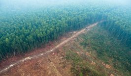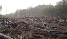
Deforestation in South America, especially Brazil, is now being perpetrated at an alarming rate. The reasons for this are manyfold, with the roots of the issue often originating in the political sphere. However, the geographic and societal isolation of the Amazon and other rainforests also help contribute to its ease of exploitation. Once political will to protect the forest dissipates, there is little to stop loggers – legal or otherwise – increasing their activities.
But, of course, that’s not to say the Amazon is not home to anyone. In Brazil, around 900,000 indigenous peoples, separated into over 256 distinct communities, call the rainforest home. These people have a direct and critical interest in maintaining the delicate balance of the rainforest and its biodiversity. Traditionally, these groups have been much maligned when it comes to deforestation, largely due to their remoteness and technological limitations. But now efforts are being made to join their in-depth local knowledge with the latest modern technology.
Rainforest Foundation US has been working since 1988 to help protect the rainforests of Central and South America. They were also one the first NGOs to highlight the plight of indigenous peoples, including the violation of their rights in accordance with the UN’s 2007 Declaration on the Rights of Indigenous Peoples. They also understand that indigenous communities are not simply passive victims, but can also actively assist in climate protection and provide skills and expertise not available to many outsiders.
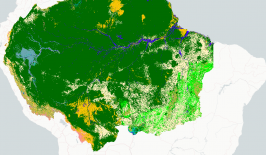
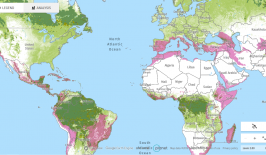
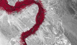
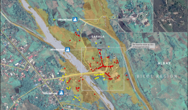
To this end, RFUS launched a territorial monitoring system, Rainforest Alert, which marries the latest in surveillance and monitoring technology with the traditional knowledge of locals. By using maps provided by Global Forest Watch, RFUS can highlight areas where deforestation has taken place, often in real time. However, the project goes much further than simply providing drones and satellite imagery. It also creates structures in which indigenous communities can formalise their complaints and direct them effectively to the necessary authorities. As Tom Bewick, Peru Country Director for RFUS, explains, the information gleamed from technology is only useful is it actually results in acton on the ground.
“What good does the information do if it’s only seen by a bunch of academics and people in glass buildings? The whole point is putting it into action.”
To make this happen, RFUS has developed a five-step programme:
- Ensure legal rights to control territory
One of the reasons indigenous land is so frequently targeted is due to a lack of formal declarations ensuring control and rights. With the assistance of RFUS, indigenous communities are provided with the relevant deeds and documents to enshrine their ownership of their land in the legal system.
- Monitor with technology
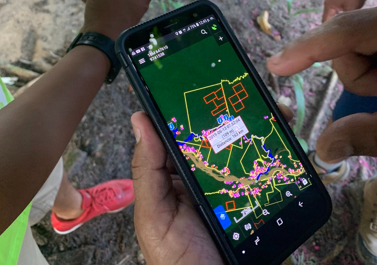
Local communities are then provided with tools, such as smartphones, drones and satellite imagery which can be used to spot and identify cases of deforestation. Once it has been spotted, an alert is sent to the indigenous communities who can then investigate the violations on the ground and document evidence. In cases of off-grid communities, the information is physically couriered to the communities via boat.
- Formalise decision making
Once evidence has been collected, the indigenous community comes together in official meetings to make a group decision on what should be done next. Official monitors are elected from within the communities, creating roles of responsibility and leadership, as well as long term expertise. Such developments are important to ensure complaints have a solid basis from which to apply pressure.
- Engage government and enforce
Now equipped with evidence, a community mandate and the relevant documentation, indigenous communities can make direct complaints to the necessary authorities regarding illegal deforestation. The combination of these factors allows them to make more data-driven and complete complaints which are much harder for the authorities to ignore.
- Build sustainable economies
Once deforestation has been limited, Rainforest Foundation also works with locals to assist in reforestation projects, and sustainable agriculture.
To test their approach, the RFUS team conducted a peer-reviewed study, released in July 2021, which showed illegal deforestation in the Peruvian Amazon was reduced 52 per cent using the Rainforest Alert approach. They also found their approach was much more cost-effective than previous methods, and delivered much higher returns. The foundation now hopes to replicate this success story across other areas of the Amazon, most notably the Roraima state of the northern Brazilian Amazon, as well as in Guyana and Panama.
The use of technology such as satellites and drones to monitor deforestation is not particularly new. Previously at RESET, he have written about the use of satellites to track deforestation, as well as the role AI can play in sustainable forestry. However, the Rainforest Alert system takes this concept even further by combining it with indigenous rights, community governance and self-sufficiency. This allows it to also take advantage of another huge resource in the rainforest: the knowledge and passion of the indigenous people to protect their own lands.