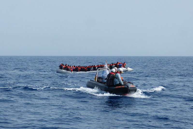
Every year, thousands of people still make their way across the Mediterranean in the hope of a better life. They have experienced wars and abject poverty or have been persecuted in their countries of origin. Many of them never arrive. Since 2014, more than 25,261 people have drowned in the Mediterranean, and in 2022 alone (as of 09 November 2022) there were 1,912 refugees.
Sea rescue is mainly organised by donation-funded NGOs such as Seewatch or Seebrücke, which search the escape routes with ships and planes for boats in distress. But often the boats are only discovered when it is already too late.
As part of a research project, Peter Lanz has set out to find a solution that can quickly and reliably locate boats – and has developed a radar detector.
Peter, what exactly is the radar detector?
The idea is to use the images from radar satellites to find boats in distress and to support sea rescue in the central Mediterranean. To do this, we are working on a programme that will automatically locate the boats. A detector searches the satellite images and provides the coordinates of possible boat locations. These can then be communicated to rescue forces on the ground together with a timestamp. We chose radar because it is not disturbed by clouds or rain and does not require sunlight. This allows for more recordings in better quality compared to optical sensors.

The radar images do not show the boat itself, but the imprint that the boat leaves on the water surface, right?
That is what we assume. Dry plastic and wood is invisible to radar. With special radar methods, the flattening of the water surface under the dinghy can be seen. The slipstream the boat creates should also be visible, just as water drops on the boat’s surface suddenly make it visible and people and the outboard motor leave traces in the radar image. All this is quite variable and the combination of all this is the anomaly we are looking for with the detectors.
How reliably do the detectors work and how quickly is the information available for sea rescue?
The reliability of the detection depends on a number of factors. Besides the choice of the best detectors, the wind speed, which is closely linked to the wave height, plays an important role. In the first phase of the project, we were able to show that the detection works well on a lake, i.e. in calm seas. Currently, we are researching up to which sea state we can still find the boats. The results will be published in a new paper in the coming months.
What was the initial idea to develop a “detection tool” for refugees?
The idea was born in 2015, when more and more people fled across the central Mediterranean Sea and the number of victims increased steadily. With our project, we want to support civilian sea rescue in their work on the one hand, and on the other hand offer a way to document the ongoing flight movements and associated illegal pushbacks. With the advantage that this strategy can only be blocked with difficulty by nation states.
What were particular challenges in developing the detector?
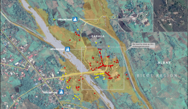
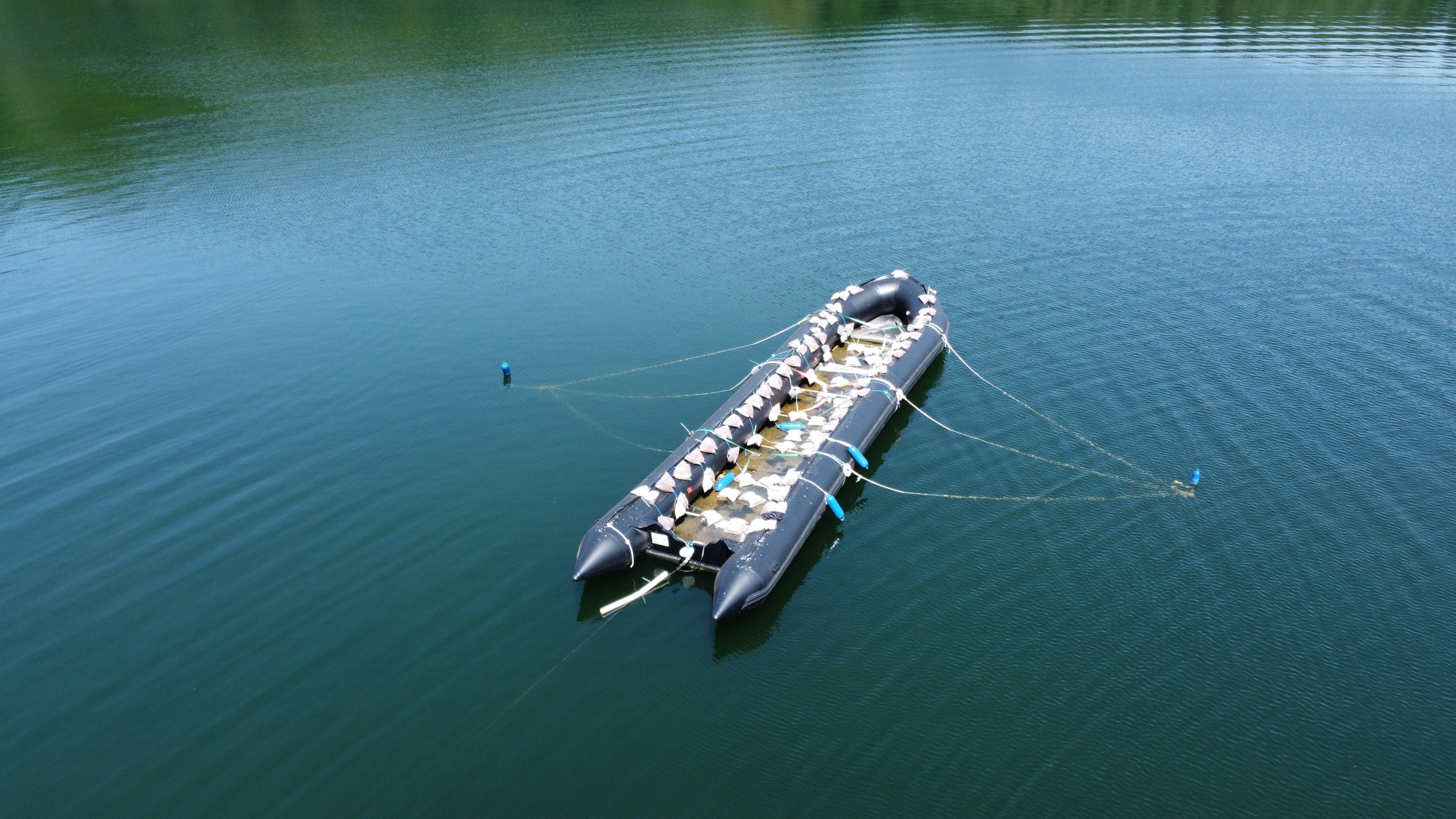
At the beginning of the project, it quickly became clear that it would be difficult to obtain the test radar data that was indispensable for the project. At least in the civilian sector, there were no freely available radar images of such boats on the open sea in real situations. So we organised two data campaigns in 2017 and 2022 on lakes near Berlin to create our own collection of test data. These were organisationally big challenges for a small project like ours.
What will happen when the detector proves itself on the high seas?
Wir hoffen natürlich darauf, damit einen Beitrag leisten zu können. Allerdings könnten aktuell noch die hohen Kosten der Of course, we hope to be able to make a contribution with it. However, the high costs of the satellite data could still be a reason why NGOs stick to the current strategies of finding refugees in distress from ships and planes.