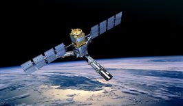
For several years now, the remote sensing and geoinformation experts at the Department of Geoinformatics at the University of Salzburg (Z_GIS) have been working together with “Doctors without Borders”. They provide humanitarian aid workers with important map material during their missions. The data basis for this are images from satellites. They are used to investigate accessibility after flooding, to estimate population figures, to determine the effects of war or to detect changes in land cover. RESET spoke to Lorenz Wendt, a remote sensing expert at the Department of Geoinformatics at the University of Salzburg.
Lorenz, what does your work with Doctors Without Borders look like exactly?
Our cooperation with Doctors Without Borders Austria started in 2011, when we were involved in various research projects to find out what satellite images could be useful for their work. After initial reservations about using this technology in a humanitarian context, we have since developed a very close cooperation. Meanwhile, Doctors Without Borders has built up a very competent and agile young team of geoinformaticians, which we support in two ways. On the one hand, we run an operational earth observation service for Doctors Without Borders on site. This means that whenever employees of Doctors Without Borders in the countries of operation or one of the five operational centres request a satellite image analysis, this request goes to us and we deliver a map product within a few days, sometimes even within hours. The applications range from “situational awareness”, i.e. the presentation of the situation on the ground, to the production of base maps, the study of accessibility, for example in the event of flooding, the estimation of population figures, and the documentation of the effects of war or changes in land cover, which in turn have an impact on the spread of malaria-transmitting mosquitoes.
Other areas of research have grown out of that service. For example, we are working on adapting and further developing our methods so that we can provide information that can be implemented as quickly as possible in a rapidly changing world. We launched a new project in July, the Christian Doppler Laboratory gEOhum (laboratory for geospatial and EO-based humanitarian technologies). There we are investigating how we can take our existing processes to a new level and react even faster through the increased use of neural networks. We’re also looking at how to make accurate population estimates in cities where there are multi-storey buildings, for example. That’s where 3D data can help.
And what exactly do you provide them with?
For Doctors without Borders it always comes down to improving people’s medical care. The first questions are: Where are these people and how many are there? We can provide answers to these questions by mapping buildings, tents and huts. From their size and number as well as local samples of the number of inhabitants, Doctors Without Borders can then estimate the total number of people in a camp, district or even a rural area and plan personnel and materials accordingly.
We handle every stage of the delivery process: from ordering and evaluatin satellite images using semi-automated procedures to producing the final maps. For that we work closely with our specialised partner, Spatial Services GmbH, a spin-off from the University of Salzburg. In most cases we deliver the prepared satellite image, the extracted buildings as a data layer and one or more maps.
How does remote sensing support the work of MSF?
In conflict areas in particular, visiting the area to get an overview of the situation can be difficult and sometimes dangerous. This is where the view from above helps. Although the employees on site know that things have happened in specific places, what they need is concrete figures about the people affected in order to be able to react accordingly. Satellite images are very helpful here. Typical areas of operation include South Sudan, the northeast of Nigeria and the Democratic Republic of Congo. Doctors Without Borders, and therefore we too, are focussed more on providing an accurate picture of the situation in the areas where they are working and providing aid, than providing a bigger picture of migration flows.
Nevertheless, it can still be useful to take a look at areas that are completely inaccessible due to the security situation, in order to make note of whether, for example, the agricultural area is decreasing, if villages have been set on fire or abandoned. That information serves as evidence for political work, but also helps us to predict how many displaced people we can expect to find in certain areas.
How important are remote sensing and AI-based methods of analysis for Doctors without Borders?
There was some initial wariness at first, but now the use of satellite images and geoinformatics has become firmly established at Doctors Without Borders and other organisations. The establishment of the GIS unit at Doctors Without Borders is evidence of that. It’s existed for several years now. Geoinformaticians are involved in many projects where it’s about finding out where things are and what should be done where. Satellite images often form the basis for those kind of considerations. The experts then combine the mapping results with information that’s been collected on the ground.
Do you also present the results of your research so that they’re also understandable for non-experts?
As part of our work with Doctors Without Borders, we mainly produce customised maps for operational use, so our target group isn’t the general public but instead a limited group of professional users. Nevertheless, we have to make sure that our maps are “properly” understood. Our close contact with Doctors without Borders helps us to do this. When it comes to presenting the results to the general public, there are now many ways to compile maps, videos, photos and texts to create clearly structured and literally “illustrative” documentation. When we’re working directly in the field, we don’t use those options all that often. There, it’s important that the information is accessible without an Internet connection, and even under challenging conditions. So the most important medium is still a good old map as a PDF which you can simply print out and take with you.
Und zum Schluss: Gibt es Anstrengungen, die bei euch entwickelte Methode auch auf weitere Einsatzbereiche oder Organisationen auszuweiten?
Das neue Projekt wird von Ärzte ohne Grenzen und der österreichischen Christian-Doppler-Gesellschaft und dem Digitalisierungsministerium kofinanziert. Die direkten operationellen Entwicklungen sind also zunächst exklusiv für Ärzte ohne Grenzen; wissenschaftliche Ergebnisse veröffentlichen wir jedoch in wissenschaftlichen Zeitschriften, so dass sie auch anderen Forschungsgruppen zur Verfügung stehen. Wir haben in den vergangenen Jahren auch mit anderen Organisationen zusammengearbeitet, wie dem Österreichischen Roten Kreuz für Wasserprojekte in Nepal und Äthiopien, und dem Internationalen Komitee des Roten Kreuzes IKRK in Gaza. Natürlich möchten wir, dass unsere Arbeit möglichst vielen Organisationen und damit Menschen nützlich ist und sind daher immer offen für weitere Kooperationen.
And finally, are there efforts to extend the methods you’ve developed into other areas or use them in other organisations?
The new project is co-financed by Doctors Without Borders, the Christian Doppler Research Association and the Austrian Ministry of Digitalisation. The direct operational developments are therefore initially exclusive to Doctors Without Borders, although we do publish our results in scientific journals so that they are also available to other research groups. In recent years, we have also worked with other organisations, such as the Austrian Red Cross for water projects in Nepal and Ethiopia, and the International Committee of the Red Cross ICRC in Gaza. Of course we want our work to be useful to as many organisations and thus people as possible, and are therefore always open to further cooperation.
This article is part of the RESET Special Feature “Satellites for Sustainable Development”. Click here to explore all of the articles in the series.
This is a translation of an original article that first appeared on RESET’s German-language site.


