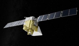
Every day, thousands of satellites circle our planet. These satellites measure a vast array of data points that are vital for comprehending our planet’s ever-changing landscape. It’s images from satellites that show us weather forecasts, gas levels in our atmosphere, ocean pollution, urban expansion and anything else that can’t be understood from ground level.
However, the true value of satellites isn’t the images themselves, as beautiful as they may be. It’s the data obtained from these images. However, extracting data from satellite images is not as straightforward as you might think.
WHAT ARE THE CHALLENGES OF ANALYSING SATELLITE IMAGES?
Large and complex datasets: Satellite imagery often involves vast amounts of data, especially when dealing with high-resolution images or long-time series data. Managing, storing and processing this data efficiently requires robust computational resources such as machines and data centres and often highly specialised software.
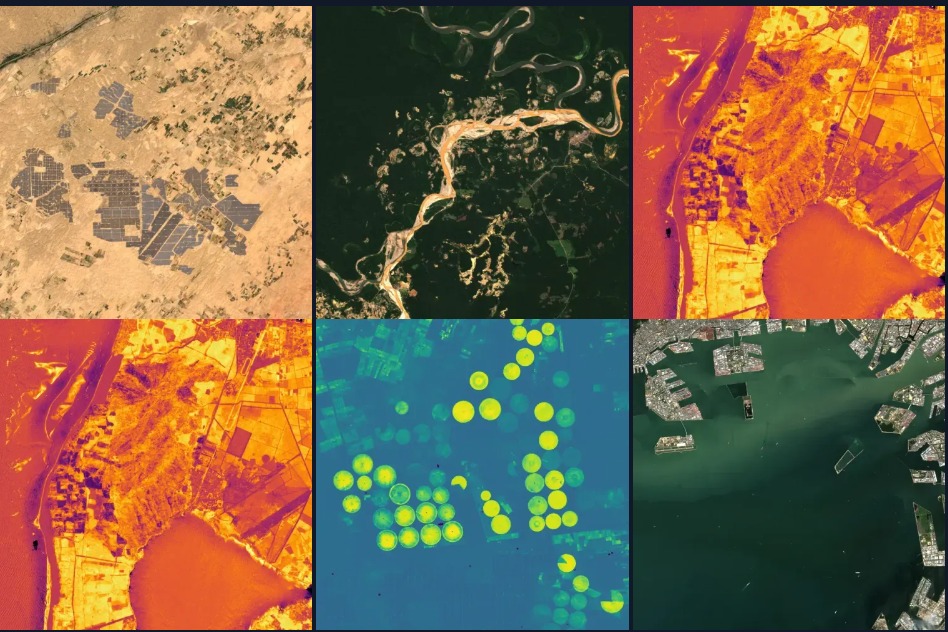
Multispectral and hyperspectral data: Satellites capture images in multiple wavelengths, not just visible light. Multispectral (few bands) and hyperspectral (hundreds of bands) images provide a wealth of information but require sophisticated techniques to interpret
Object detection and classification: Identifying specific features like buildings, forests, water bodies or vehicles can be difficult. Likewise, clouds can obstruct the view of the Earth’s surface, making extracting specific data difficult.
Interdisciplinary knowledge: Effective analysis often requires knowledge beyond image processing. Understanding the specific environmental context being studied requires specialists, while advanced techniques, particularly those involving machine learning, require an extensive understanding of statistics and mathematics.
Read our article: Outer Space for All! Just How Accessible Is ESA’s Satellite Data?
Extracting data is where the real work starts
A new venture focusing on environmental and climate monitoring specialises in making satellite imagery accessible. askEarth analyses and interprets satellite images provided by The European Space Agency in partnership with the European Commission, with specialised software to analyse our forests.
This technology arrives just as the European Union’s Deforestation Regulation is set to take effect at the end of 2024. “Companies will need to provide proof that their products do not contribute to deforestation,” explains Gaetan Petit, co-founder of askEarth.
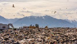
The new regulation aims to curb global deforestation by ensuring that products entering the market—such as timber, soy, cocoa, coffee, rubber, palm oil and cattle—are not linked to forest destruction or degradation.
This requirement will be enforced retroactively from 2020, so the pressure is on for European companies to understand their data—fast.
askEarth makes complex data accessible
Founders of askEarth, Gaetan Petit and Manuel Gerold, have a long-standing interest in space technologies. The increasing demand for satellite images, particularly for Environmental Social Governance (ESG) reporting, led them to establish askEarth in 2023. According to Petit, “It isn’t easy to analyse [satellite] images. Data science is needed in order to filter out the required information.” As most companies lack in-house data scientists, Petit and Gerold saw an opportunity to step in.
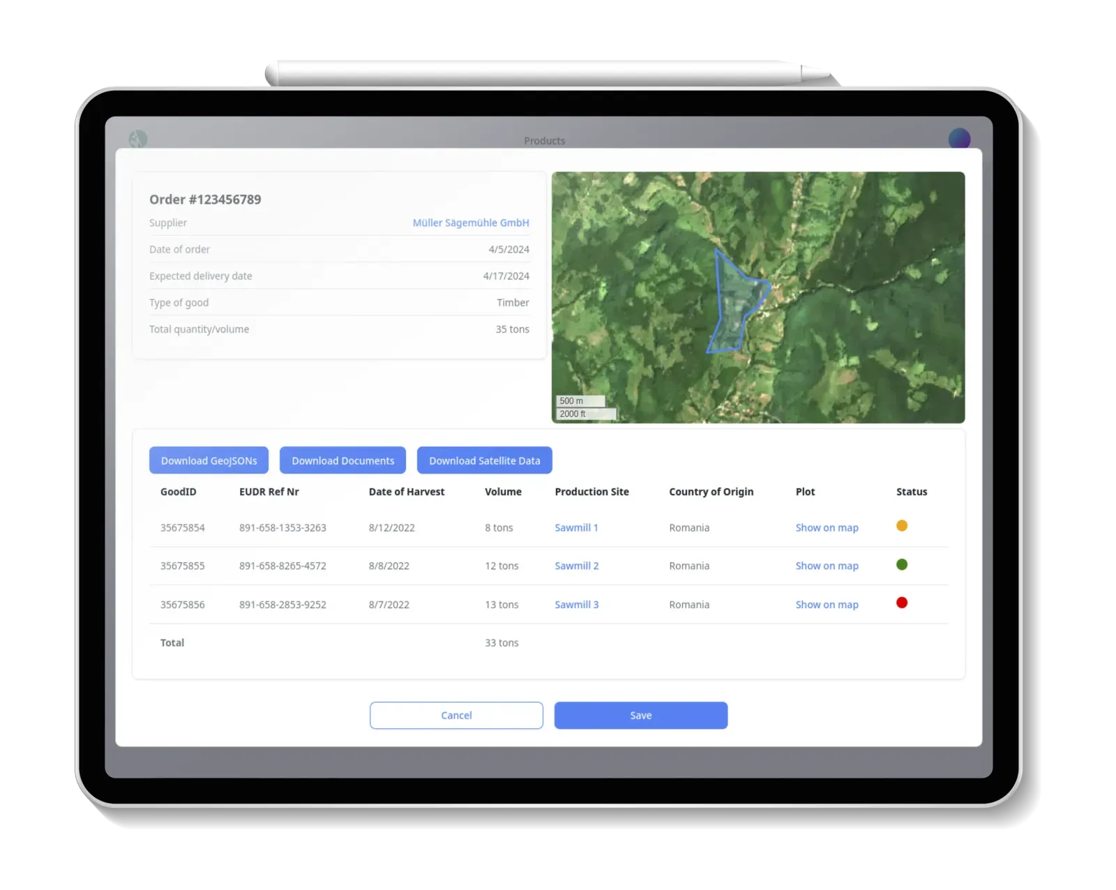
Their solution helps businesses maintain compliance with the EU Deforestation Regulation (EUDR) across their entire value chain. It not only analyses the compliance of goods before delivery but also issues alerts as needed. It traces goods through their production and its cloud-based software integrates with enterprise resource planning (ERP) systems, allowing businesses to determine whether they can accept certain timber deliveries. askEarth then ensures that relevant product information is delivered directly to customers and handles the paperwork, automatically generating compliance reports for the European Commission to ensure that companies have proof of their efforts.
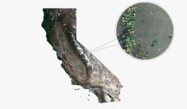
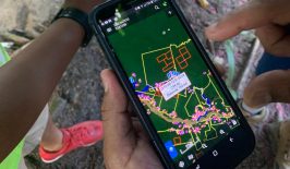
And, it’s not just businesses that can benefit from their technology. askEarth also offers the Explorer, a publicly accessible tool that allows users without extensive technical knowledge to visualise satellite data. Simply select a region and time frame and observe changes in vegetation, forest fires and other environmental factors through a user-friendly and modern timeline video format. This server-less feature is not only useful for businesses and scientists but also serves as an important educational resource. askEarth conducts regular workshops for schools, helping geography teachers incorporate the Explorer into their lessons to give the next generation a better understanding of our planet.

Satellites for Sustainable Development
When it comes to protecting the environment and tracking changes in our climate, satellites and drones have become indispensable. If only there wasn’t the issue of all that space debris…
In RESET’s in-depth special feature, we take a look at the potentials – and pitfalls – of satellites and drones for a sustainable future on this planet.
Looking to the future with askEarth
Looking ahead, askEarth plans to expand its product portfolio to align with future ESG regulations, aiming to provide comprehensive solutions for climate monitoring and reporting. “We want to evolve with policy changes, like the Deforestation Regulation, and continue to develop in this direction,” says Petit.
askEarth, along with already established initiatives such as OpenSpaceData, is poised to play an important role in environmental monitoring. Through the removal of technical barriers, askEarth promotes a more nuanced and widespread understanding of the changes our planet is facing. This could well make a significant impact in the fight to protect it—one image at a time.