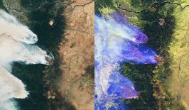
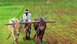
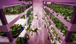
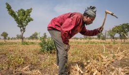
Our current method of food production is anything but sustainable. Intensive farming practices and the massive use of chemicals are leaching our soil and polluting our water. In addition, agriculture is responsible for a huge amount of our water consumption; the World Bank states that agriculture accounts (on average) for 70 percent of all freshwater use globally. According to the Water Scarcity Clock, an interactive web tool from the World Data Lab, around 2.3 billion people in the world live in a situation of water scarcity, and the trend is rising. To make matters worse, the global rise in temperature, which is leading to periods of drought in many regions, has led to an increase in demand for water – especially in Europe, which experienced unprecedented heat waves last year.
One reason for the high demand for water is the choice of crops. Farmers don’t always plant crops that are suited to the local climate, instead taking economic considerations into account first. As a result, all too often, water-intensive crops end up on fields with little natural irrigation or rainfall. Other reasons for the high demand on our water supplies include outdated irrigation techniques and irrigation systems that are not adapted to local conditions. It is therefore urgently necessary for us to reduce global water consumption as soon as possible – and it’s worth taking a look at innovative solutions.
The company SmartCloudfarming, a spin off from the Technical University of Berlin, has set itself the goal of helping agriculture develop in a way that both protects the soil and produces only low emissions. The founders Michele Bandecchi and Suvrajit Saha with their international team of soil and data specialists are focusing on data-driven soil management. Their 3D soil map is based on satellite and aerial images, which are automatically evaluated using algorithms based on neural networks. We talked to SmartCloudfarming’s co-founder, Suvrajit Saha, to find out more.
© Suvrajit Saha
Your company is called “SmartCloudFarming”. Could you explain what it is that you offer?
Our startup is a soil analysis company. We are closing the existing data gap for precision farming using satellite data and image acquisition to perform area-wide soil analysis and determine important parameters such as soil moisture, organically-bound carbon and soil nutrients and then displaying those features on a 3D soil map.
How do the 3D soil maps help agricultural companies?
Agricultural companies can benefit from simplified and digital soil management – which is what our 3D soil maps offer. They can find out what the soil conditions are like below the surface of the ground – and over a wide area rather than just at specific points. This knowledge enables them to carry out the right treatment measures. It can help them to increase fertility and thus yields, while reducing the consumption of water and fertilizers.
So you provide information about the properties of the soil, in particular the moisture content, nutrient content in the soil and the carbon content. Where do you get that information from?
We use publicly available satellite images and aerial photographs and we integrate optical and radar data from Sentinel 1 and 2 as well as Landsat 8 in order to evaluate it. This information is processed using highly complex algorithms in order to determine the values and distribution on and below the ground. Later on we may also decide to use data from commercial satellites that produce high resolution imagery.
What resolution are you able to offer?
Currently we offer a resolution of 30 by 30 metres. Our accuracy averages over 90 percent, which is surprisingly high. In the coming months we would like to increase this to about 98 percent.
How does the evaluation process work?
The data is evaluated using algorithms and neural networks. We also use image recognition in some steps, but that tends to be the exception. We also compare the results with existing laboratory values.
How does the solution affect the sustainability and environmental compatibility of the sites?
Our 3D soil maps and simplified soil management have an immediate effect on sustainability and environmental compatibility, as they help to reduce agricultural emissions, and reduce the consumption of fertilizers and water.
Who benefits from this approach and what is the impact?
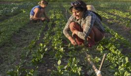
Everyone who works in agriculture could benefit from our 3D soil maps. But the end users are the farmers themselves, who will save time and money and who will be able to meet the increasingly strict environmental requirements. Agricultural companies also benefit and can reduce their time spent on soil management by over 80 percent. Today, soil management is primarily done by hand, which takes a lot of time. Our solution handles many work steps remotely, from a distance, or automates them. The user does not need to make the journey to the field to collect soil samples and send them to the laboratory. The planning steps in advance are also eliminated, as are the associated administrative costs. This allows us to minimise the steps in the process that have to be carried out manually and reduce the time needed to do it. Our approach is different in many respects: We are not working on improving existing processes and procedures. Instead we want to use new approaches to fundamentally redesign an outdated system.
This article is part of the RESET Special Feature “Satellites for Sustainable Development”. Click here to explore all of the articles in the series.
This a translation of an original article that first appeared on RESET’s German-language site.