If there is one thing that is abundant in the world, it is data. But especially when it comes to the field of humanitarian aid, the information that is required to back up important decisions is often missing. How can we turn data into valuable information that can provide the basis for crucial decision-making? And how can we get that information to the people working in areas hit by war and other disasters?
The German Aerospace Centre (DLR) established the “Humanitarian Technologies” initiative back in 2019, planning to harness the power of aerospace technologies to support international development projects and emergency humanitarian programmes.
As part of the initiative, DLR has now launched the “Data4Human” project, in cooperation with Human Rights Watch, the German Red Cross, the World Food Programme (WFP), the United Nations Development Programme (UNDP) and the Humanitarian Team of Open Street Map.
What is special about Data4Human is that the aid organisations are free to communicate exactly what information it is that they urgently need, with DLR responding by developing solutions tailored to the organisations’ needs – using its expertise, satellite imaging data of Earth, radar and optical data from the Sentinel satellites and information from the European environmental observation system COPERNICUS.
A technological boost from earth observation + internet observation
Want a more concrete example? Here are a few: The German Red Cross is often forced to start its work in the field when they still don’t have enough information about the sitution. Where exactly are rapid relief measures needed after an earthquake? What regions are the most damaged after a flood? This is where the “perhaps most dynamic approach” of Data4Human comes in, according to DLR project manager Dr Anne Schneibel.
Researchers from DLR’s Earth Observation Center (EOC), the Center for Satellite Based Crisis Information (ZKI) and the Institute of Data Sciences use self-learning algorithms to automatically evaluate and scan for key words on social media, news sites, newsrooms and platforms such as Twitter and create location references. Combined with geographical information from remote sensing data and aerial photographs, the German Red Cross will be provided with digital maps featuring the disaster’s “hot spots”. Using these, the aid workers can make sure help gets to exactly the places where it is most needed.
Bernadette Jung from DLR Communications predicts that combining the ‘physical’ satellite observations with ‘digital’ observations on the internet will prove particularly powerful – maybe even making it possible to visualise and trace flows of refugees or human rights violations.
Artificial intelligence finds destroyed roads, railways and bridges
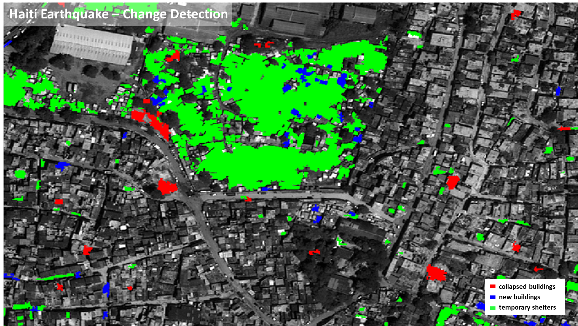
The UN World Food Programme provides a second example. Here, too, in the event of a disaster, aid workers need quick and precise information about where and to what extent infrastructure such as roads, railways or bridges have been destroyed. By using satellite data and aerial photographs, Data4Human aims to create a solution that uses intelligent algorithms to explore satellite imagery and automatically and quickly show the location and degree of destroyed infrastructure. The photo below shows how building damage is automatically recorded – using intelligent data processing methods from remote sensing. The example here shows loss analyses for several natural catastrophes in the USA, before and after Hurricanes Florence and Matthew, a flood catastrophe in the Midwest, and the bush fire in Santa Rosa. The DLR experts used the public xView2 data set for the analysis.
According to Dr. Anne Schneibel, the first results carried out with test data have been a success. By the end of 2021, the researchers want to deliver a product that’s ready for use. The Data4Human product range will also be used to monitor reconstruction measures and the effectiveness of humanitarian aid, with the aim being to equip as many organisations as possible with the tools.
This is a translation of an original article that first appeared on RESET’s German-language site.
This article is part of the RESET Special Feature “Artificial Intelligence – Can Computing Power Save Our Planet?” Explore the rest of our articles in the series right here.


