Like carbon dioxide, methane (CH4) is also a greenhouse gas that can contribute to climate change. However, it has generally received less attention and been seen as less important than carbon by governments and the media. This may be due to the fact that, in percentage terms, fewer methane emissions are produced and that it has a shorter lifetime in the atmosphere than carbon dioxide does. But the impact of methane on our global climate should not be underestimated: methane’s effect on climate change – kilogram to kilogram – is more than 25 times stronger than CO2.
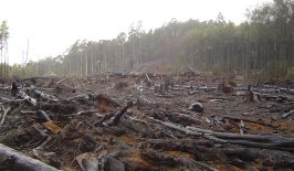
When talking about climate change and methane, the discussion regularly turns to livestock farming, and especially cattle – famously emitters of high amounts of methane. But methane emissions are also produced in other areas too. Natural gas, for example, consists mainly of methane. The combustion of natural gas also produces CO2, meaning it’s already not particularly environmentally-friendly, but methane can also escape into the atmosphere, especially while its being produced and transported, for example through leaks in pipelines. The big problem with these leaks is that they are often not discovered or are only discovered after some time, meaning large amounts of the gas are able to freely escape into the atmosphere.
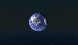
US company Bluefield has now developed a technology that detects leaks like this by combining satellites and optical methods. Satellites around the size of a rucksack are equipped with optical sensors to collect data on methane emissions around the world. When sunlight strikes the Earth, it is reflected back into space at the speed of light. When it hits a spot that emits methane, the methane blocks part of the light spectrum and leaves behind a unique spectral signature. Bluefield’s microsatellite-based sensor captures the light reflected from the ground and uses state-of-the-art optical techniques to detect the spectral fingerprint of the methane. The design of the sensor makes it possible to detect over 20,000 spectral lines, which together form a methane “fingerprint”. This makes it possible to identify the points where methane escapes. Machine vision algorithms are then used to further improve the data. Bluefield uses an optical technique that has been proven in twelve NASA space missions to date, in a scaled-down version.
Across Europe, the loss of natural gas from leaks and thus methane emissions is estimated by a study by the European Commission to be between 0.5 and 1.5 percent of total emissions. The largest producers of natural gas – the USA, Russia and countries in the Middle East – are not included in this study. Moreover, these are only estimates and the number of unreported cases is most likely much higher.
The use of new technologies such as Bluefield can help to analyse the situation more accurately and reduce emissions. According to the International Energy Agency, leak detection has so far relied mainly on the use of portable thermal cameras to identify emission sources, which is a slow and cumbersome process. Satellites and other airborne measurement techniques, such as drones or aircraft, can therefore provide a much faster and more comprehensive overview.
This is a translation by Mark Newton of the original article which first appeared on RESET’s German-language site.