With a focus on oil spills, natural gas fracking and illegal fishing networks, SkyTruth’s work empowers NGOs and members of the public to become environmental watchdogs with a bird’s eye view.
SkyTruth is a US-based organisation that’s on a mission to make satellite imagery both more accessible and meaningful. Drawing from a range of satellite and remote sensing technologies, its employees decipher patterns in the visual data to reveal meaningful stories, allowing users to understand the impact of human industrial activity on the natural environment.
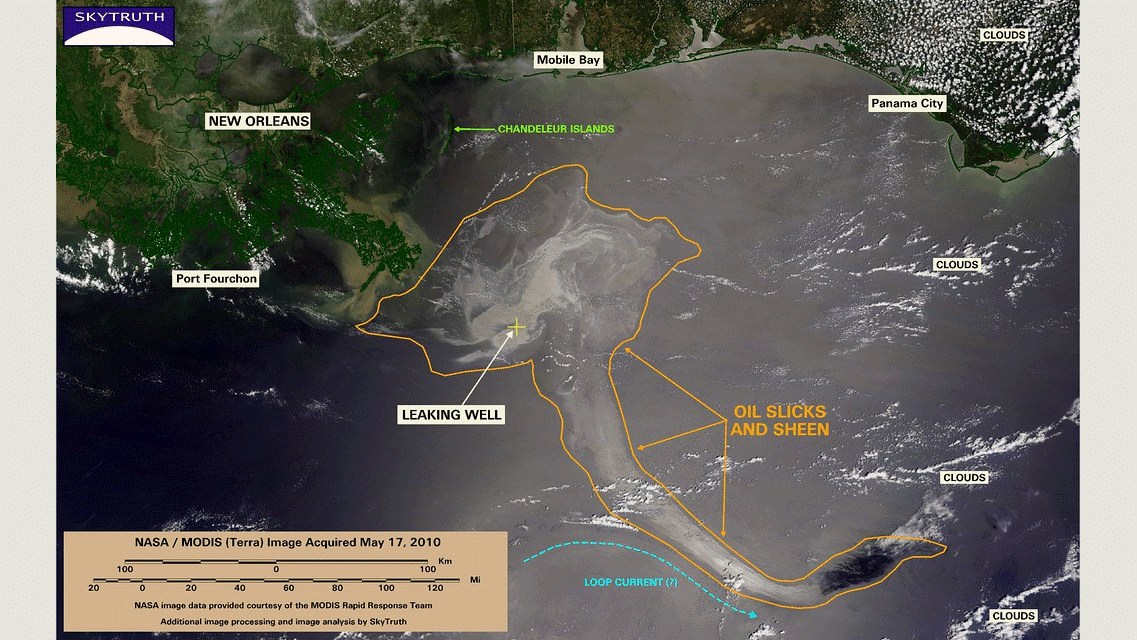
At the core of SkyTruth’s ethos is the idea that “if you can see something, you can change it”. One of their biggest claims to fame is their part in the 2010 BP oil spill cleanup, but they also run projects that focus on natural gas extraction and illegal fishing or logging.
To the 21st-century eye, SkyTruth’s job may seem relatively straightforward: most of us are used to seeing satellite imagery (via Google Earth, for example) and take for granted that each image shows us what we need to see. When tracing specific patterns, however, like chemical trends in the atmosphere or marine vessels that shouldn’t be there, the process becomes more tricky. “Some images need no interpretation,” SkyTruth founder John Amos admits to RESET. “They so clearly show something, that even a non-expert can understand what story the image is telling. However, that’s often not the case—the view from space is really foreign to most of us humans, and abstract.”
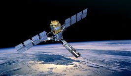
Corresponding to these varying needs, SkyTruth has different types of satellite imagery to take into consideration. Some (like the kind you see in Google Earth) simply capture images on the part of the electromagnetic spectrum that is visible to the human eye. Others make use of infrared technology, or sensors that beam down radar energy and measure what bounces back up to them as a way to decipher chemical content.
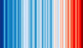
This last method is particularly relevant for tracing chemicals in the air. Atmospheric gases like ozone, water vapour and nitrogen dioxide—as well as major industrial pollutants like CO2, methane and sulphur dioxide—can be identified through their sunlight absorption ‘fingerprint’. Because each substance blocks the transmission of sunlight at specific wavelengths, satellites can measure where on the spectral frequency band the solar radiation is dropping out. “And you can measure its concentration based on the strength of that absorption of the sun’s energy at those specific wavelength bands,” Amos adds.
Moreover, developments in satellite technology have made it possible to pinpoint the source of pollutants like methane down to individual facilities and power plants that account for a large proportion of leaks, otherwise known as ‘super emitters’. This has the potential to dramatically advance how satellite imagery can be used to hold industry accountable. As Amos puts it, SkyTruth’s task is to “stay abreast of changes in available satellite technology, and to understand how those different systems can best be used to promote conservation and environmental awareness.”
Making satellite images accessible and meaningful
After SkyTruth has captured these data sets, that data then needs to be deciphered and made accessible to researchers, non-experts and the general public “so that everybody can take advantage of the work we had to do to make that data useful.” With only twelve full-time employees, the SkyTruth team falls on the smaller side of nonprofits, meaning that beyond social media outreach, they don’t have the luxury of a dedicated PR arm to enhance their visibility to potential users.
To get around this, SkyTruth work alongside bigger organisations who do have these resources. One such partner is Oceana, a leading marine conservation group with whom SkyTruth and Google partnered in order to launch the Global Fishing Watch project in 2016. On the day that RESET spoke to SkyTruth, for example, they had just circulated a paper studying a huge case of illegal fishing in North Korean waters through Oceana’s media outreach channels, which allowed them to alert reporters to the findings.
Amos sees SkyTruth as an interpreter between swathes of data and the average member of the public. “I was motivated to start SkyTruth because I wanted anyone who cared about the environment to be able to see for themselves how human activity was changing the environment, and to be able to see that anywhere on the planet where that was happening,” he notes. “That’s still a big motivator for us—to try and make our work available and understandable to a non-expert general audience.”
Encouraging grassroots action – with images from above
While SkyTruth gathers huge amounts of data from all over the world, its findings can be channeled into engaging and empowering local communities. In the case of the BP oil spill back in 2010, for example, SkyTruth set up an interactive map identifying pollution hotspots, and encouraged members of the public to compare those data with the pollution they were able to see on the ground. One user in Florida made over a hundred submissions within the app, and her contributions were so useful that she started to receive support from state environmental officials who urged her to carry on. Indeed, it was partly due to her efforts that BP was forced to continue their clean-up operation for many more months than they would have done if left to their own devices.
More recently, SkyTruth has found other ways to engage with communities, such as “FrackFinder”, a project that invites people to analyse images for signs of oil and gas drilling infrastructure. They’ve also set up an interactive tool called SkyTruth Alerts, which allows people to monitor a specific location using its corresponding satellite imagery—almost like a neighbourhood watch with a bird’s eye view. One of SkyTruth’s own employees started using the SkyTruth Alerts function to monitor an area in Philadelphia, where her mother lived. The app alerted her to a leak from a nearby oil refinery that had caused the release of two hundred pounds of hydrogen cyanide into the air (unbeknownst to surrounding neighbourhoods). While there is an existing system in place to report on incidents like this, it’s slow to respond and relatively inaccessible: the National Response Center publishes one spreadsheet per week detailing nationwide leaks and spills—hardly an actionable data set for your average local.
By using SkyTruth Alerts—which uses automation to gather this data in real-time—that employee was not only able to quickly share the news with a local reporter and alert the affected residents to the risk at hand; but also began to pay attention to that particular refinery in the long term.
“Things that used to go unnoticed are now being noticed,” Amos says. Streamlining this process means that communities are now empowered to monitor what they can’t necessarily see in their environment—and motivated to engage in and safeguard its wellbeing.
Demystifying the impacts of fracking
Methane is one of the main pollutants on SkyTruth’s watch list: this time in the context of hydraulic fracturing (fracking). Particularly in the US, fracking is often framed as a better alternative to coal, despite the fact that in some cases, gas fracking has been shown to be just as harmful to the climate as certain types of coal mining. Evidence shows that methane levels in the air have increased dramatically due to fracking leaks, which occur frequently even with the use of modern infrastructure. With a toxicity level between 20 to 70 times that of CO2, methane poses a huge risk to our environmental safety. Together with the fact that fracking also contaminates groundwater supplies, its prospects don’t look good.
It’s no more encouraging that fracking’s industrial practices are also shrouded in secrecy. Even when residents actually become aware that their groundwater is contaminated, offending companies have been accused of buying their silence with large payouts and NDAs, knowing that the resident’s chances of selling and moving are unlikely without the help of a buyout. SkyTruth wants to dissolve this culture of secrecy. “Industry and government just don’t want to give information to the public,” Amos explains. “Information invites scrutiny and hard questions that need to be answered. The first stage of breaking that pattern of obfuscation and obscurity is making the information available.”
By using increasingly sophisticated satellite technology to measure methane concentration in the atmosphere, SkyTruth hopes to track meaningful changes in the long- as well as short-term to demystify the effects of fracking operations. The organisation has also been impactful in fighting for better policy in the US: SkyTruth testified to congress on the issue, after which the federal government agreed to create a system of public disclosure that encompassed the majority (although not all) of the thousands of chemicals involved in the fracking process.
The future of satellite monitoring
“I’ve been amazed by the acceleration of technology,” Amos says, and with ten years’ experience of using satellite imagery as an exploration geologist for oil and gas mining companies, he’s well placed to know. He remembers how, for the majority of his career, satellite imagery was an expensive, inaccessible tool that was used to take snapshots months (or even years) apart. At 4400 USD per image, these kinds of technologies were certainly not available to the general public.
Fast forward to 2020, and anyone with a computer can download millions of satellite images from 50 year-old US government database Landsat for free. “Now, even school kids can make satellites and launch them into orbit. We have satellites taking high resolution images at least once, sometimes twice a day.” Amos explains. Combined with advancements in cloud computing and machine learning, analysis can occur on a massive scale in near real-time, “we’re rapidly entering an era when we can be made aware of what’s going on around the world yesterday—maybe even this morning!”
For all the challenges that lie ahead, younger generations will be able to use satellite technology to walk into the future with eyes open, and to hold industry accountable for its ecological footprint. “Conservation organisations don’t know how to take advantage of that power yet, but they will learn,” Amos hopes. “I think it will provide opportunities for intervention, or to stop environmental damage from even occurring. That’s something I’ve looked forward to since I started SkyTruth almost twenty years ago, and we’re almost there now.”This article is part of the RESET Special Feature “Satellites for Sustainable Development”. Click here to explore all of the articles in the series.