Since 1970, the Amazon rainforest has lost around 20 per cent of its forest cover due to both legal and illegal deforestation in the region. This makes the Amazon the biggest deforestation front in the world, with its large scale and geographic spread across national borders adding to the challenge of monitoring and controlling deforestation.
The Amazon Conservation Association (ACA) recognized this issue and has recently published a new paper looking into how modern civil society can tackle deforestation. Their primary weapon in the struggle is to utilise modern, small satellites and, eventually, machine learning to give monitors a headstart in spotting deforestation activities while there is still time to act against them.
An Eagle’s Eye View of Deforestation
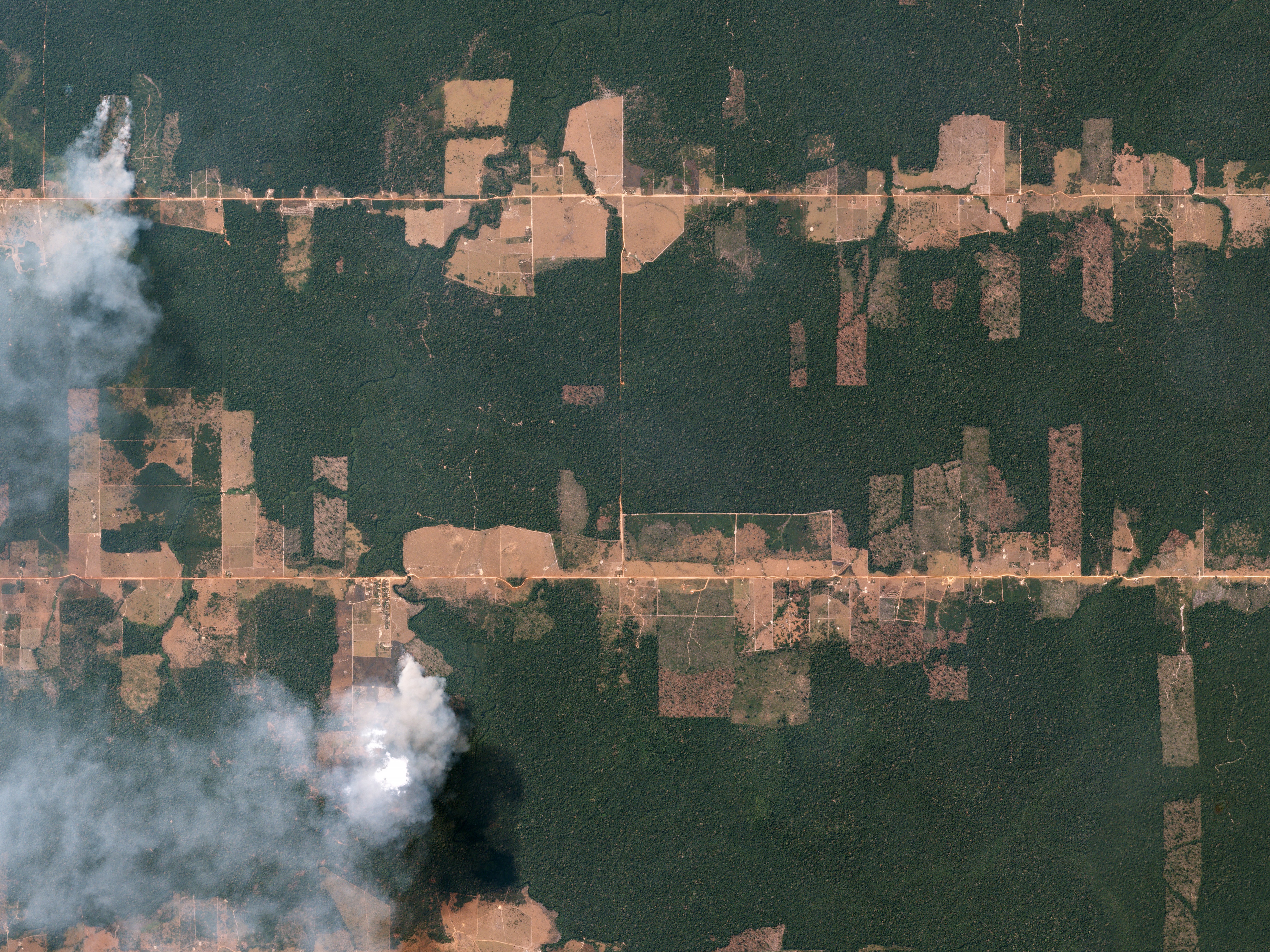
In the past, deforestation was frequently only spotted once it was already completed, making it incredibly difficult to effectively police and control. The recent explosion in satellite imagery technology, however, has provided many of the tools needed to increase the speed and efficiency of spotting deforestation. For example, satellite imagery specialists Planet have launched around 175 miniature satellites that can provide organizations such as ACA with up-to-date, high resolution imagery at a previously unprecedented scale.
Previously, Landsat satellites were able to provide images around every sixteen days at a maximum resolution of around thirty meters. Although this was helpful to NGOs, its lack of relative precision and timeliness limited its effectiveness. Planet’s satellites, on the other hand, provide almost daily updates at a resolution of three meters. Not only does this allow monitors to spot deforestation earlier, but also often allows them to see the cause of the deforestation – whether it’s logging, road clearing, mining or other activities. Once they know the cause, they can better mobilise governmental and civil society actors to investigate it.
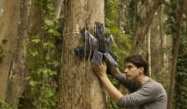
Once an area of deforestation has been spotted, actors on the ground can investigate with site visits or drones. Meanwhile, NGOs and researchers, such as the Global Land Analysis and Discovery lab at the University of Maryland, can send out updates to interested parties, disseminating the information widely and further exposing the loggers.
Currently, the process still requires a large amount of human involvement – a significant challenge when you’re attempting to monitor the largest rainforest in the world. Ultimately, the ACA team hopes to employ machine learning algorithms to better identify areas of forest change. By comparing new satellite images with older archival images, artificial intelligence can prioritise areas of deforestation, enhance identification of the cause and even identify specific crop types which have been planted in cleared agricultural land.
The Challenges Ahead
Ultimately, however, the long term success of these endeavours will depend on how governmental institutions handle the information. To be fully effective, the paper’s authors stress that greater coordination is needed between NGOs, policy makers and communities on the ground.
There are certainly challenges in this area. There’s still corruption amongst governmental organizations concerning forestry and mining, while intimidation by logging and mining gangs is rife in some isolated regions. In particular, murders linked to land disputes in the Amazon have been steadily increasing since 2000, with around 350 to 400 people murdered each year – further limiting the power of NGOs to intervene. By 2030, the WWF predicts the Amazon could lose up to 27 per cent of its rainforest.
Luckily, things appear to be moving in the right direction, with several nations establishing new watchdog agencies, such as Peru’s innovative National Monitoring and Control System. The use of technology is central to the operations of these agencies and ACA hopes the lower cost, greater speed and improved transparency of their work can provide the ammunition needed to more effectively battle deforestation.