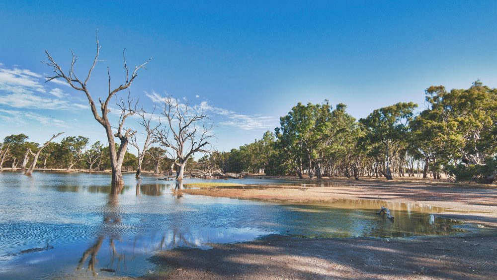
The world’s freshwater reserves are shrinking as a result of man-made climate change. Yet rivers and lakes are essential as a source of fresh water and food. It is therefore all the more important to protect these sensitive ecosystems. While this is usually achieved using random samples and water sensors, researchers from the company GlobeWQ want to enrich this data using satellite systems.
Lake Victoria in East Africa is the second largest freshwater lake in the world and provides millions of people in Tanzania, Uganda and Kenya with important livelihoods. With an area of 68,800 square kilometres, it is one-fifth the size of Germany. Despite this enormous size, inflowing wastewater, pollution from oil spills, contamination from rubbish and other factors jeopardise the water quality of the lake.
As part of a World Water Quality Alliance pilot project, Lake Victoria has been monitored for some time using a new method of water analysis that combines data from three sources.
Triangulation combines data from three sources
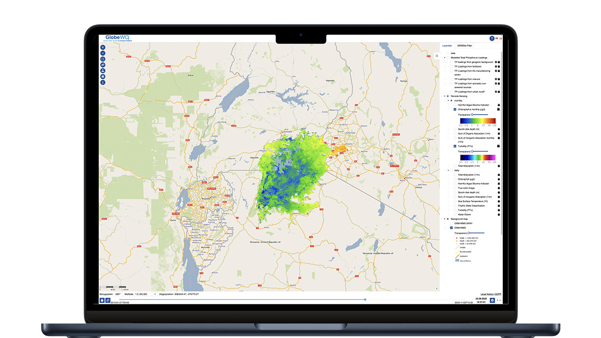
GlobeWQ is the first source to carry out measurements directly in the lake. The so-called in-situ measurement data comes on the one hand from the analysis of laboratory data and on the other hand from the water sensors used. GlobeWQ adds that this data is informative. However, as random samples, they can only poorly depict rapid changes in water quality.
To counteract this, the data is supplemented with measurement data from satellites. Although this data is less accurate, it is available almost everywhere in the world. At the same time, developments can also be compared with stored data from previous decades.
GlobWQ also uses mathematical models to obtain information about future developments in water quality and quantity. In combination, this “triangulation” of the collected measurement data enables the researchers to make particularly comprehensive statements about the water resources on our planet.
The example of Lake Victoria shows exactly how this works.
Monitoring water quality in the world’s second largest lake
Lake Victoria is part of the states of Tanzania, Uganda and Kenya. According to estimates from 2007, it serves as a source of food for around 30 million people. At the same time, neighbouring countries use the lake for fishing and as a source of energy through the use of waterworks and reservoirs.
Despite its size, the Global Nature Fund declared Lake Victoria “Threatened Lake of the Year” in 2005, and not much has improved. This is because the lake’s ecosystems are repeatedly threatened by pollution from sewage and waste. The consequences are a lack of oxygen in the lake and an accumulation of nutrients, also known as eutrophication. In the past, the latter has often led to extreme algae growth in Lake Victoria.
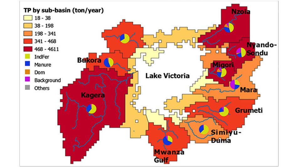
The World Water Quality Alliance therefore sees an urgent need to monitor the nutrient levels in Lake Victoria more closely. This is where GlobeWQ’s triangulation method comes in.
In their study, the GlobeWQ researchers describe the monitoring of algae formation as a particular challenge. The spread of harmful algae can sometimes take place within days or even hours. In-situ measurement data, which is collected in Lake Victoria, simply cannot react to this in time.
Satellite data, on the other hand, can measure both the temperature in the lake and the occurrence of chlorophyll-a at short intervals. These findings enabled the researchers to identify more precisely which inflows cause the critical eutrophication in the lake.
What conclusions does GlobeWQ draw from this?
Five tributary catchment areas of Lake Victoria are responsible for more than 70 percent of the annual concentration of phosphorus. A single tributary, that of the Gulf of Winam, is in turn largely responsible for the high concentration of chlorophyll-a
The combination of in-situ measurements, satellite data and modelling can therefore provide us with more complete information on eutrophication in lakes in the future. Ideally, this will lead to faster protective measures that give water bodies a chance to regenerate sooner.